|
search place name
|
||
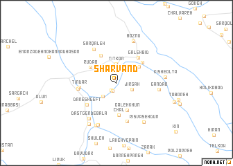
Shārvand (Lorestān, Iran)Shārvand is a town in the Lorestān region of Iran. An overview map of the region around Shārvand is displayed below.
regional and 3d topo map of Shārvand, Iran ::
Shārvand airports ::
The nearest airport is QMJ - Masjed Soleiman Shahid Asyaee, located 100.3 km south of Shārvand.
Other airports nearby include AWZ - Ahwaz (187.0 km south west), Nearby towns ::
Baznavīd (1.4km south west) //
Pandegī (1.4km south) //
Jīrgāh (2.4km south east) //
Tītkan (3.0km north) //
Mobārakābād (2.8km south west) //
Kīsh-e Soflá (4.0km north east) //
Galeh Khūn (4.6km south) //
Rūd Āb (4.3km north west) //
Darreh Tārīk (4.9km north west) //
Chāl (5.2km south) //
Chāleh Fahreh (4.8km north east) //
Galeh Bīd (5.0km north east) //
Dareshgeft (5.3km south west) //
Tīndar (5.1km west) //
Sārābād (5.3km west) //
Tīt Mollā (6.3km south) //
Sar Qal‘eh (6.2km north west) //
Gandāb (5.8km east) //
Dastgerd-e Bālā (6.9km south west) //
Boznū' (7.2km north) //
Chārakī (7.2km south) //
Bard Shamshīr (7.4km south) //
Rīsvāsehgūn (7.4km south east) //
Dastgerd-e Pā'īn (7.6km south west) //
Kīsh-e ‘Olyā (6.7km east) //
[all distances 'as the bird flies' and approximate] 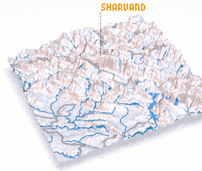 Places with similar names to Shārvand, Iran ::
// Tiouré Fandou (NE)
// Shīr Āvand (IR)
// Shīrāvand (IR)
// Shīrāvand (IR)
// Shīrāvand (IR)
// Shīrāvand (IR)
// Shīrvāneh Deh (IR)
// Churvinto (BO)
Disclaimer :: Information on this page comes without warranty of any kind |
||
|
Where is Shārvand? Elevation and coordinates ::
Latitude (lat): 32°51'21"N Longitude (lon): 49°37'30"E
Elevation (approx.): 1347m (map arrows pan, magnifying glasses zoom) |
||
|
Visiting Shārvand? Hotel/Accommodation ::
Book a hotel in Shārvand Travel Guide ::
Buy a travel guide for Iran rental cars ::
car rental offers GPS waypoint ::
download a GPX waypoint (PoI) of Shārvand for your GPS receiver
|
||