|
search place name
|
||
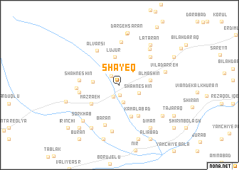
Shāyeq (Ardabīl, Iran)Shāyeq is a town in the Ardabīl region of Iran. An overview map of the region around Shāyeq is displayed below.
regional and 3d topo map of Shāyeq, Iran ::
Shāyeq airports ::
The nearest airport is TBZ - Tabriz Intl, located 152.4 km west of Shāyeq.
Other airports nearby include RAS - Rasht (169.2 km south east), Nearby towns ::
Kolūjeh (1.6km south) //
Meymand (1.7km north west) //
Kaleh Sar (2.0km south) //
Pīrnaq (2.8km south) //
Shāh Neshīn (2.7km south east) //
Eslāmābād (3.4km west) //
Lūjūr (4.5km north) //
Ālmāshīn (3.9km east) //
Gūgeh (5.2km south) //
Mazra‘eh (4.6km south west) //
Kamālābād (5.4km south east) //
Shāh Neshīn (5.0km west) //
Kandovān (5.1km west) //
Alvārsī (6.0km north west) //
Asb-e Marz (5.8km north east) //
Owjūr (6.7km north) //
Lāy (5.3km west) //
Bārān (6.6km south) //
Vīrtheq (7.3km south) //
Āldāshīn (6.8km north east) //
Vīlā Darreh (6.0km east) //
Lāţarān (7.3km north east) //
Deymān (7.6km south west) //
Sorkhāb (7.2km south west) //
Āyrān Darrehsī (8.2km north) //
Golestān (7.2km south east) //
Dīmān (7.7km south east) //
Dargeh Sarān (8.3km north) //
Gūgarchīn (7.1km west) //
[all distances 'as the bird flies' and approximate]  Places with similar names to Shāyeq, Iran ::
Disclaimer :: Information on this page comes without warranty of any kind |
||
|
Where is Shāyeq? Elevation and coordinates ::
Latitude (lat): 38°7'37"N Longitude (lon): 47°58'23"E
Elevation (approx.): 1968m (map arrows pan, magnifying glasses zoom) |
||
|
Visiting Shāyeq? Hotel/Accommodation ::
Book a hotel in Shāyeq Travel Guide ::
Buy a travel guide for Iran rental cars ::
car rental offers GPS waypoint ::
download a GPX waypoint (PoI) of Shāyeq for your GPS receiver
|
||