|
search place name
|
||
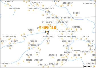
Shīrkolā (Iran)Shīrkolā is a town in Iran. An overview map of the region around Shīrkolā is displayed below.
regional and 3d topo map of Shīrkolā, Iran ::
Shīrkolā airports ::
The nearest airport is THR - Teheran Mehrabad Intl, located 157.5 km west of Shīrkolā.
Nearby towns ::
Lalehband (0.0km north) //
Garrūdbār (1.9km south) //
Ma‘dan Pāk (2.4km north east) //
Pārsī (2.6km north) //
‘Asal (3.0km north west) //
Mīār Kolā (3.7km north) //
Dasht Mīān (3.7km north) //
Estakhr Sar (3.7km north) //
Yūrneh (3.7km north) //
Panderem (3.7km south) //
Mowmj-e Kheyl (3.7km south) //
Ţāle‘ (3.7km south) //
Kanīj Kolā (3.7km north) //
Shīr Darreh (3.5km north east) //
Now Deh (4.5km east) //
Ẕa‘īf Kolā (4.9km east) //
Ḩājjī Kolā (4.9km east) //
Memshī (5.4km west) //
Zangīān (5.8km south west) //
Estakhr Sar (5.8km north east) //
Now Sereh (5.8km north east) //
Khātūn-e Rūd Bār (6.3km south west) //
Emāmzādeh Haft Barādar (6.3km north east) //
Karī Kolā (6.3km north east) //
Evāt (6.7km south) //
Ma‘dan-e Zīrāb (7.6km north) //
‘Ālīyeh Kolā (7.6km north) //
Bālā Zīrāb (7.6km north) //
Khalīl Kolā (7.6km north) //
[all distances 'as the bird flies' and approximate] 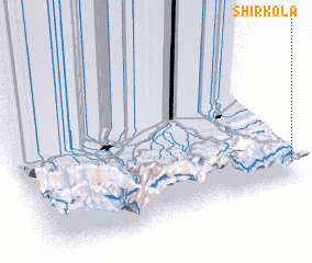 Places with similar names to Shīrkolā, Iran ::
// Shyrokyy Luh (UA)
// Charkli (RU)
// Charīklū (IR)
// Chārqolī (IR)
// Charāikol (BD)
// Chāraikola (BD)
// Char Goāli (BD)
// Char Kāli (BD)
// Char Kāli (BD)
// Churigualla (CL)
Disclaimer :: Information on this page comes without warranty of any kind |
||
|
Where is Shīrkolā? Elevation and coordinates ::
Latitude (lat): 36°6'0"N Longitude (lon): 52°59'0"E
Elevation (approx.): 661m (map arrows pan, magnifying glasses zoom) |
||
|
Visiting Shīrkolā? Hotel/Accommodation ::
Book a hotel in Shīrkolā Travel Guide ::
Buy a travel guide for Iran rental cars ::
car rental offers GPS waypoint ::
download a GPX waypoint (PoI) of Shīrkolā for your GPS receiver
|
||