|
search place name
|
||
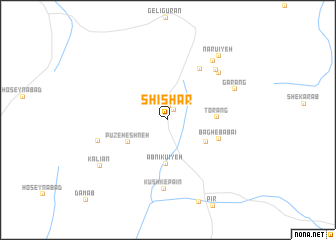
Shīshār (Kermān, Iran)Shīshār is a town in the Kermān region of Iran. An overview map of the region around Shīshār is displayed below.
regional and 3d topo map of Shīshār, Iran ::
Shīshār airports ::
The nearest airport is KER - Kerman, located 169.8 km north of Shīshār.
Other airports nearby include BND - Bandar Abbass Intl (173.9 km south), Nearby towns ::
Kūshk-e Bālā (1.3km north east) //
Kūrang (1.6km north) //
Kordbastān (4.5km south east) //
Āb Nīkū'īyeh (4.9km south) //
Pūzeh Eshneh (4.6km south west) //
Ţorang (4.8km east) //
Bāgh-e Bābā'ī (5.4km south east) //
Shādīān (6.5km north east) //
Kūshk-e Pā'īn (7.7km south) //
'oseynābād (7.2km north east) //
Seyyedābād (7.3km north east) //
Bonāb (7.2km west) //
Garang (7.4km north east) //
Nar Āb (8.0km north east) //
Narū'īyeh (8.7km north east) //
Kal Āvors (8.7km north east) //
Kalīān (8.4km south west) //
[all distances 'as the bird flies' and approximate]  Places with similar names to Shīshār, Iran ::
Disclaimer :: Information on this page comes without warranty of any kind |
||
|
Where is Shīshār? Elevation and coordinates ::
Latitude (lat): 28°45'9"N Longitude (lon): 56°44'57"E
Elevation (approx.): 1997m (map arrows pan, magnifying glasses zoom) |
||
|
Visiting Shīshār? Hotel/Accommodation ::
Book a hotel in Shīshār Travel Guide ::
Buy a travel guide for Iran rental cars ::
car rental offers GPS waypoint ::
download a GPX waypoint (PoI) of Shīshār for your GPS receiver
|
||