|
search place name
|
||
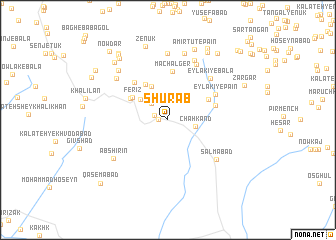
Shūrāb (Iran)Shūrāb is a town in Iran. An overview map of the region around Shūrāb is displayed below.
regional and 3d topo map of Shūrāb, Iran ::
Shūrāb airports ::
The nearest airport is XBJ - Birjand, located 25.0 km north of Shūrāb.
Nearby towns ::
Sūrach (0.9km west) //
Gol (1.3km west) //
Kalāteh-ye Karbalāʼī Ḩoseyn (2.4km north west) //
Chahkand (2.6km east) //
Kalāteh-ye Mīr (3.5km north west) //
Kalāteh-ye ‘Alī ‘Abbās (4.0km north west) //
Kalāteh-ye ‘Alījān (4.0km north west) //
Kalāteh-ye Golnāz (4.5km north west) //
Ferīz (4.2km north west) //
Kalāteh Bāghuk (4.3km north west) //
Rūmenjān (4.4km north east) //
Machālger (5.5km north) //
Shahrestānak (4.8km east) //
Kārīz Now (5.2km north west) //
‘Eylakī-ye Pā'īn (5.3km north east) //
‘Eylakī-ye Bālā (6.1km north east) //
Salmābād (6.3km south east) //
Gazzeh (6.8km north east) //
Kalāt-e Aḩmad Beyg (7.1km north) //
Tījdar (6.7km north west) //
Cheshmeh Shūsh (7.4km north) //
Āb Shīrīn (6.7km south west) //
Amrūtūk (7.6km north) //
Kalāteh-ye Mīr ‘Abbās (7.3km north west) //
Amīr Tūt-e Pā'īn (8.3km north) //
Zenūk (8.5km north) //
Kālenj (8.4km north east) //
Ostād (8.1km north west) //
Zādonbeh-ye Pā'īn (8.3km north west) //
[all distances 'as the bird flies' and approximate] 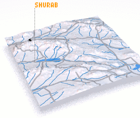 Places with similar names to Shūrāb, Iran ::
Disclaimer :: Information on this page comes without warranty of any kind |
||
|
Where is Shūrāb? Elevation and coordinates ::
Latitude (lat): 32°41'0"N Longitude (lon): 59°11'0"E
Elevation (approx.): 1820m (map arrows pan, magnifying glasses zoom) |
||
|
Visiting Shūrāb? Hotel/Accommodation ::
Book a hotel in Shūrāb Travel Guide ::
Buy a travel guide for Iran rental cars ::
car rental offers GPS waypoint ::
download a GPX waypoint (PoI) of Shūrāb for your GPS receiver
|
||