|
search place name
|
||
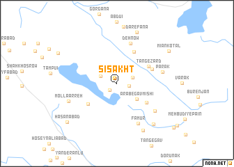
Sī Sakht (Fārs, Iran)Sī Sakht is a town in the Fārs region of Iran. An overview map of the region around Sī Sakht is displayed below.
regional and 3d topo map of Sī Sakht, Iran ::
Sī Sakht airports ::
The nearest airport is SYZ - Shiraz Shahid Dastghaib Intl, located 70.5 km east of Sī Sakht.
Other airports nearby include BUZ - Bushehr (118.0 km south west), Nearby towns ::
Qal‘eh-ye Deh Pāgāh (1.5km south west) //
Mālekī (1.7km east) //
Deh Pāgāh (2.4km north east) //
Helak (2.6km north west) //
‘Arab-e Gāvmīshī (3.8km south east) //
Konār-e Khoshk (5.2km south west) //
Qal‘eh-ye Mīrzā'ī (5.2km south east) //
Tang-e Zard (5.2km north east) //
Dasht-e Barm (5.7km north east) //
Ārandī (5.4km north east) //
Deh Now (6.7km north) //
Fāmūr (7.1km south east) //
Qal‘eh-ye Nārenjī (6.9km south east) //
Parak (6.7km east) //
Mollā Arreh (7.3km south west) //
Nargeszār (8.4km south east) //
Bībī Hūrī (8.3km south east) //
Dār-e Fanā (8.7km north) //
Mīān Kotal (8.9km north east) //
Ḩasanābād (9.3km south west) //
[all distances 'as the bird flies' and approximate] 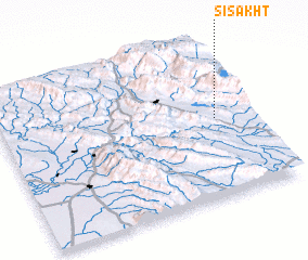 Places with similar names to Sī Sakht, Iran ::
Disclaimer :: Information on this page comes without warranty of any kind |
||
|
Where is Sī Sakht? Elevation and coordinates ::
Latitude (lat): 29°30'31"N Longitude (lon): 51°51'49"E
Elevation (approx.): 840m (map arrows pan, magnifying glasses zoom) |
||
|
Visiting Sī Sakht? Hotel/Accommodation ::
Book a hotel in Sī Sakht Travel Guide ::
Buy a travel guide for Iran rental cars ::
car rental offers GPS waypoint ::
download a GPX waypoint (PoI) of Sī Sakht for your GPS receiver
|
||