|
search place name
|
||
Sohrāb (Fārs, Iran)Sohrāb is a town in the Fārs region of Iran. An overview map of the region around Sohrāb is displayed below.
regional and 3d topo map of Sohrāb, Iran ::

Sohrāb airports ::
The nearest airport is KIH - Kish Island, located 128.4 km south east of Sohrāb.
Other airports nearby include BDH - Bandar Lengeh (186.9 km south east), Nearby towns ::
Chahār Ţāq (1.3km north west) //
Katak (2.2km north east) //
Qal‘eh-e Moḩammad Ţāher (2.5km west) //
Khargū (2.5km west) //
Shīrīnū (2.9km south east) //
Yūrd-e Sohrāb (4.2km west) //
Moḩammad ‘Alī (4.9km north) //
Qal‘eh-e Morādī (4.4km west) //
Moḩammad-e ‘Olyā (4.8km north west) //
Sharafābād (5.3km north west) //
Eḩshām (6.1km south east) //
Tamrū (7.2km north west) //
Berkeh-ye Mollā'ī (7.7km north west) //
Shāh Bahrām (8.2km north west) //
Nūr ed Dīnī (8.2km north west) //
Deh Kohneh (8.2km south east) //
Khāres (9.0km north) //
Chāh-e Darān (9.5km south west) //
Khalīfehhā (9.7km south west) //
Tol-e Morādī (11.1km south west) //
[all distances 'as the bird flies' and approximate] 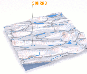 Places with similar names to Sohrāb, Iran ::
Disclaimer :: Information on this page comes without warranty of any kind |
||
|
Where is Sohrāb? Elevation and coordinates ::
Latitude (lat): 27°30'13"N Longitude (lon): 53°17'5"E
Elevation (approx.): 471m (map arrows pan, magnifying glasses zoom) |
||
|
Visiting Sohrāb? Hotel/Accommodation ::
Book a hotel in Sohrāb Travel Guide ::
Buy a travel guide for Iran rental cars ::
car rental offers GPS waypoint ::
download a GPX waypoint (PoI) of Sohrāb for your GPS receiver
|
||