|
search place name
|
||
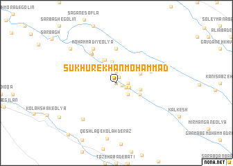
Sūkhūr-e Khān Moḩammad (Ostān-e Kermānshāh, Iran)Sūkhūr-e Khān Moḩammad is a town in the Ostān-e Kermānshāh region of Iran. An overview map of the region around Sūkhūr-e Khān Moḩammad is displayed below.
regional and 3d topo map of Sūkhūr-e Khān Moḩammad, Iran ::
Sūkhūr-e Khān Moḩammad airports ::
The nearest airport is KSH - Bakhtaran Shahid Ashrafi Esfahani, located 99.5 km east of Sūkhūr-e Khān Moḩammad.
Other airports nearby include SDG - Sanandaj (145.8 km north east), Nearby towns ::
Sūkhūr-e Ḩasan Khān (0.0km north) //
Morovvatī (0.8km south east) //
Qarīyeh Nāmdār (1.0km north) //
Sūkhar-e Pā'īn (1.4km south east) //
Sūkhūr-e Nāmdār-e Elāhī (1.9km north) //
Sūkhūr-e Kohzād (1.9km north) //
Qeyţūl (1.9km north) //
Sūkhūr-e Nāmdār-e ‘Abdī-ye Bālā (1.9km north) //
Ḩeydarīyeh (1.9km north) //
Sūkhūr-e Shahbāz-e Shīrī-ye ‘Olyā (2) (1.5km east) //
Sūkhūr-e Nāmdār-e Mīrzāpūr (1.5km east) //
Sūkhūr-e Rashīd-e Khosh Eqbāl (1.5km east) //
Sūkhūr-e Shahbāz-e Najafī (1.5km east) //
Sūkhūr-e Shahbāz-e Shīrī-ye Soflá (1.5km east) //
Sūkhūr-e ‘Alī Moḩammad-e Gol Moḩammadī (1.5km east) //
Sūkhūr-e Shahbāz-e Shīrī-ye ‘Olyā (1) (1.5km east) //
Moḩammadī (1.8km east) //
Sūkhūr-e Rashīd-e ‘Olyā (2) (2.4km south east) //
Sūkhar-e Moḩammadī (3.5km north) //
Sūkhar-e Bālā (3.3km east) //
Garāmī (3.6km north west) //
Sūkhar-e Khān Jān (3.5km north east) //
Sūkhūr-e Karamī (3.6km south east) //
Sūkhūr-e Rashīd-e Soflá (3.6km south east) //
Sūkhūr-e Morovvatī (3.6km south east) //
Moḩammadī-ye Soflá (4.0km north) //
Bābā Rostam (4.0km north) //
Bahrāmvandī (4.0km north) //
Kāz̧em Khānī (4.1km north west) //
[all distances 'as the bird flies' and approximate] 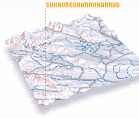 Places with similar names to Sūkhūr-e Khān Moḩammad, Iran :: Disclaimer :: Information on this page comes without warranty of any kind |
||
|
Where is Sūkhūr-e Khān Moḩammad? Elevation and coordinates ::
Latitude (lat): 34°10'0"N Longitude (lon): 46°6'0"E
Elevation (approx.): 1046m (map arrows pan, magnifying glasses zoom) |
||
|
Visiting Sūkhūr-e Khān Moḩammad? Hotel/Accommodation ::
Book a hotel in Sūkhūr-e Khān Moḩammad Travel Guide ::
Buy a travel guide for Iran rental cars ::
car rental offers GPS waypoint ::
download a GPX waypoint (PoI) of Sūkhūr-e Khān Moḩammad for your GPS receiver
|
||