|
search place name
|
||
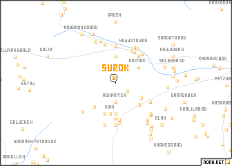
Sūrok (Yazd, Iran)Sūrok is a town in the Yazd region of Iran. An overview map of the region around Sūrok is displayed below.
regional and 3d topo map of Sūrok, Iran ::
Sūrok airports ::
The nearest airport is AZD - Yazd Shahid Sadooghi, located 47.1 km north east of Sūrok.
Nearby towns ::
Ḩājjīābād-e Bālā (2.0km south east) //
‘Askarīyeh (3.1km south) //
Mowrū (4.3km north) //
Haznak (4.0km north east) //
Solţānābād (4.2km south east) //
Deh Now (4.9km south) //
Kūhī (5.1km south) //
‘Abbāsābād (4.8km south east) //
Taqīābād (4.9km south west) //
Zardashtān (5.2km south) //
Mazra‘eh-ye Now (5.3km north east) //
Khodāābād-e Pā'īn (5.3km north east) //
Mazra‘eh-ye Ḩājjī Zeynal (5.3km north east) //
Mowr-e ‘Alīābād (5.7km south) //
Dashtbānak (5.5km north east) //
Sar Cheshmeh (5.7km north east) //
Dāmok (6.0km south) //
Mazra‘eh-ye Moḩammad Ebrāhīm (6.0km north) //
Khodāābād-e Bālā (5.9km north east) //
Mezank (5.6km south east) //
Ramekān (6.4km north) //
Ḩojjatābād (6.3km north east) //
Naşrābād-e Pīshkūh (6.3km north east) //
‘Alīābād (6.6km south) //
Gumistūn (6.8km south) //
Sorūshīn (7.0km south) //
Beh Chīn (6.5km south west) //
Raḩmatābād (7.1km north) //
Sa‘dābād (7.2km north west) //
[all distances 'as the bird flies' and approximate] 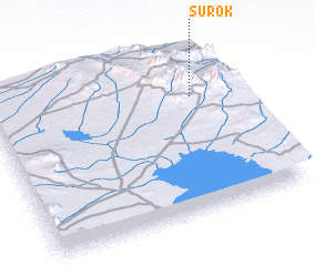 Places with similar names to Sūrok, Iran ::
Disclaimer :: Information on this page comes without warranty of any kind |
||
|
Where is Sūrok? Elevation and coordinates ::
Latitude (lat): 31°42'40"N Longitude (lon): 53°50'1"E
Elevation (approx.): 2344m (map arrows pan, magnifying glasses zoom) |
||
|
Visiting Sūrok? Hotel/Accommodation ::
Book a hotel in Sūrok Travel Guide ::
Buy a travel guide for Iran rental cars ::
car rental offers GPS waypoint ::
download a GPX waypoint (PoI) of Sūrok for your GPS receiver
|
||