|
search place name
|
||
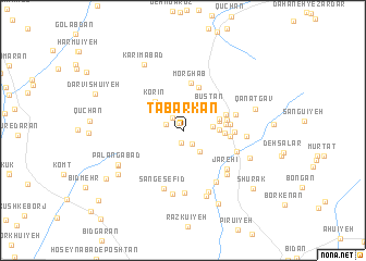
Tabarkan (Kermān, Iran)Tabarkan is a town in the Kermān region of Iran. An overview map of the region around Tabarkan is displayed below.
regional and 3d topo map of Tabarkan, Iran ::
Tabarkan airports ::
The nearest airport is KER - Kerman, located 105.7 km north of Tabarkan.
Nearby towns ::
Deh-e Sājer (0.9km north west) //
Deh Mīrzā'ī (1.3km south) //
Deh Now (1.6km south east) //
Deh-e Reẕāqolī (1.6km north west) //
Āb Baḩrī (1.6km north west) //
Deh Galūband (2.6km south east) //
Meshkān (2.7km east) //
Moshgān (3.2km east) //
Mīrdān (3.3km east) //
Būstān (3.5km north east) //
Tabar Kūh (3.5km east) //
Korīn (3.9km north west) //
Boneh Posht (3.7km east) //
Bāgh Malek (3.8km east) //
Āb Nā'ī (4.0km east) //
Jūshīr (4.0km east) //
Samī‘ābād (4.1km north east) //
Sūzan (4.7km north) //
Mīān Deh (4.2km east) //
Posht Jū'īyeh (4.3km east) //
Morghāb (4.9km north) //
Qālān (4.6km east) //
Mīān Rūd Āb (4.9km east) //
Sang Kar (5.2km south east) //
Jārehī (5.5km south east) //
Do Rudī-ye Pā'īn (6.0km south east) //
Sang-e Sefīd (6.2km south) //
Deh Zārchī (5.9km south east) //
Bongowd (6.3km south) //
[all distances 'as the bird flies' and approximate] 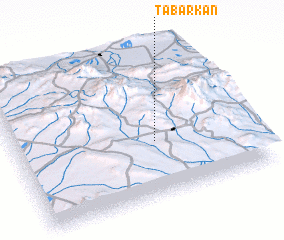 Places with similar names to Tabarkan, Iran ::
// Dobërçan (AL)
// Doborogonno (GH)
// Dobříčany (CZ)
// Dobročná (SK)
// Toberkeen (IE)
// Dobrčane (CS)
// Dobričani (CS)
// De Broeken (BE)
// De Broeken (BE)
// De Berken (NL)
Disclaimer :: Information on this page comes without warranty of any kind |
||
|
Where is Tabarkan? Elevation and coordinates ::
Latitude (lat): 29°22'23"N Longitude (lon): 56°35'36"E
Elevation (approx.): 2616m (map arrows pan, magnifying glasses zoom) |
||
|
Visiting Tabarkan? Hotel/Accommodation ::
Book a hotel in Tabarkan Travel Guide ::
Buy a travel guide for Iran rental cars ::
car rental offers GPS waypoint ::
download a GPX waypoint (PoI) of Tabarkan for your GPS receiver
|
||