|
search place name
|
||
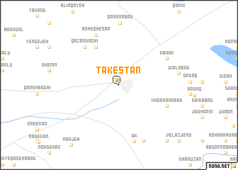
Tākestān (Iran)Tākestān is a town in Iran. An overview map of the region around Tākestān is displayed below.
regional and 3d topo map of Tākestān, Iran ::
Tākestān airports ::
The nearest airport is RZR - Ramsar, located 128.7 km north east of Tākestān.
Other airports nearby include RAS - Rasht (140.4 km north), THR - Teheran Mehrabad Intl (151.6 km east), Nearby towns ::
Āqjeh Kand (6.7km north west) //
Qāzān Dāghī (7.5km north west) //
Khorramābād (6.9km south east) //
Kahak (7.4km north east) //
‘Āsheq Ḩeşār (8.4km north) //
Ak (9.1km south) //
Maḩmūdābād-e Shārīn (9.3km south) //
Shārīn (10.7km south east) //
[all distances 'as the bird flies' and approximate] 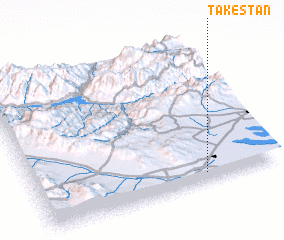 Places with similar names to Tākestān, Iran ::
// Dixietown (US)
// Teixidón (ES)
// Dehkestān (IR)
// Dūkestān (IR)
// Deka Sedēn (ET)
// Tākestān (IR)
// Dukestown (GY)
// Taxdian (CN)
// De Gaasten (NL)
Disclaimer :: Information on this page comes without warranty of any kind |
||
|
Where is Tākestān? Elevation and coordinates ::
Latitude (lat): 36°3'45"N Longitude (lon): 49°41'56"E
Elevation (approx.): 1259m (map arrows pan, magnifying glasses zoom) |
||
|
Visiting Tākestān? Hotel/Accommodation ::
Book a hotel in Tākestān Travel Guide ::
Buy a travel guide for Iran rental cars ::
car rental offers GPS waypoint ::
download a GPX waypoint (PoI) of Tākestān for your GPS receiver
|
||