|
search place name
|
||
Talūstān (Iran)Talūstān is a town in Iran. An overview map of the region around Talūstān is displayed below.
regional and 3d topo map of Talūstān, Iran ::
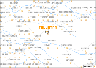
Nearby towns ::
Sar Cheshmeh (0.0km north) //
Kalleh Khar (0.0km north) //
Kamālābād (1.9km north) //
Qezlaq (1.9km north) //
Nāvestān (1.9km north) //
Khambarābād (2.4km north west) //
Sang Tappeh-ye Kheyrābād (2.4km north west) //
Gālīkash (3.3km south west) //
Āb Parān (4.0km south) //
Balūchābād (4.0km north) //
Tarājīq (4.0km north) //
Ūghān (3.5km south west) //
Ḩoseyābād-e Qorbānī (4.0km north) //
Tūrang Tappeh (5.6km north) //
Bārānī (5.6km north) //
Qal‘eh (5.6km south) //
Gīlānshāh (5.8km north) //
Amlāk-e Qolī Tappeh (4.8km south west) //
Ḩeydarābād (5.8km north) //
Āqdāsh (4.8km north east) //
Yālnī (4.8km north east) //
Mīrzā Pāng (4.7km west) //
Qanāt (6.3km north east) //
Yūrt-e Zeynal (6.3km south east) //
Mameshlī (6.3km north west) //
Bāynāl (7.4km north) //
Qal‘eh-ye Gīāūr (5.9km west) //
Āchār (7.6km north) //
Balūchābād-e Amlāk (6.2km west) //
[all distances 'as the bird flies' and approximate] 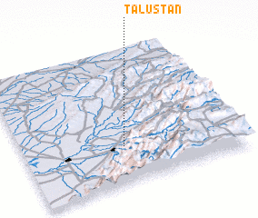 Places with similar names to Talūstān, Iran ::
// Talıstan (AZ)
// Doylestown (US)
// Dielstein (DE)
// Tolleston (US)
// Doyleston (NZ)
// Dālestān (IR)
// Doylestown (US)
// Dallastown (US)
// Doylestown (US)
// Doylestown (US)
Disclaimer :: Information on this page comes without warranty of any kind |
||
|
Where is Talūstān? Elevation and coordinates ::
Latitude (lat): 37°17'0"N Longitude (lon): 55°28'0"E
Elevation (approx.): 286m (map arrows pan, magnifying glasses zoom) |
||
|
Visiting Talūstān? Hotel/Accommodation ::
Book a hotel in Talūstān Travel Guide ::
Buy a travel guide for Iran rental cars ::
car rental offers GPS waypoint ::
download a GPX waypoint (PoI) of Talūstān for your GPS receiver
|
||