|
search place name
|
||
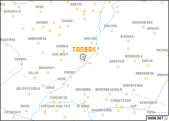
Tanbak (Lorestān, Iran)Tanbak is a town in the Lorestān region of Iran. An overview map of the region around Tanbak is displayed below.
regional and 3d topo map of Tanbak, Iran ::
Tanbak airports ::
The nearest airport is QMJ - Masjed Soleiman Shahid Asyaee, located 167.5 km south of Tanbak.
Nearby towns ::
Delyān (1.0km south east) //
Fīn (2.8km north east) //
Marzīān (4.0km north) //
Kamarī (4.5km south west) //
Gombeh (4.5km north west) //
Z̄ū ol Qadr (4.4km west) //
Chālesbār (6.4km south west) //
Ābtīn (6.4km south west) //
Aznā (6.5km south west) //
Makīābād (7.4km south) //
Shahrak-e Almahdī (7.4km south) //
Qareh Dīn (6.3km east) //
Kahrīz-e Sefīd (7.3km north west) //
Lamīs (8.1km south) //
Sīrdar (8.3km north) //
Bāgh Mūrī (7.3km west) //
Farzīān (8.3km north east) //
Parī Jān (8.7km north west) //
Bornābād-e Bālā (8.7km south east) //
Bornābād-e Pā'īn (9.5km south east) //
Gorjī (9.3km south west) //
Āqāʼī (9.3km north west) //
Shāhveleh (10.2km north west) //
[all distances 'as the bird flies' and approximate] 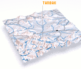 Places with similar names to Tanbak, Iran ::
// Tneybakh (RU)
// Dunback (NZ)
// Dīnī Bak (IR)
// Donbakī (IR)
// Donbokui (BF)
// Tanbaougou (BF)
// Tinboko (BF)
// Danna Baihk (IN)
// Tenibek (UZ)
// Dan Bagou (NE)
Disclaimer :: Information on this page comes without warranty of any kind |
||
|
Where is Tanbak? Elevation and coordinates ::
Latitude (lat): 33°30'0"N Longitude (lon): 49°30'0"E
Elevation (approx.): 1879m (map arrows pan, magnifying glasses zoom) |
||
|
Visiting Tanbak? Hotel/Accommodation ::
Book a hotel in Tanbak Travel Guide ::
Buy a travel guide for Iran rental cars ::
car rental offers GPS waypoint ::
download a GPX waypoint (PoI) of Tanbak for your GPS receiver
|
||