|
search place name
|
||
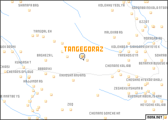
Tang-e Gorāz (Lorestān, Iran)Tang-e Gorāz is a town in the Lorestān region of Iran. An overview map of the region around Tang-e Gorāz is displayed below.
regional and 3d topo map of Tang-e Gorāz, Iran ::
Tang-e Gorāz airports ::
The nearest airport is KSH - Bakhtaran Shahid Ashrafi Esfahani, located 102.8 km north west of Tang-e Gorāz.
Other airports nearby include SDG - Sanandaj (199.4 km north), QMJ - Masjed Soleiman Shahid Asyaee (224.4 km south east), Nearby towns ::
Rashīd (0.6km east) //
‘Alī Khān-e Dāvūd Rashīd (3.2km west) //
Dāyūrāsh (4.2km north west) //
Khvosh Nāmvand (5.0km south west) //
Deh Khosrow (4.4km north west) //
Shāh Reẕāābād-e Shāh Naz̧ar (5.5km north west) //
Chenār-e ‘Olyā (6.4km south east) //
Korrehpa (6.7km south west) //
Sheykh Aḩmad (6.7km south west) //
Kal-e Gowrā (7.0km north west) //
Chenār-e Kālīāb (6.9km east) //
Kolehbān (7.0km east) //
Shahbāz Beyg (7.0km east) //
Dūl Gāvmīshān (7.0km east) //
Malekābād (7.6km north east) //
Bar Āftāb-e Seyyed Moḩammad (8.3km south) //
Bāgh-e Zāl (7.1km west) //
Cham-e Dāvūd Chenār (7.5km south east) //
Āb Bārīkī (7.8km south west) //
Būqalīān (9.9km south west) //
[all distances 'as the bird flies' and approximate] 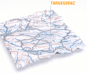 Places with similar names to Tang-e Gorāz, Iran ::
// Donji Graci (BA)
// Donje Gorice (CS)
Disclaimer :: Information on this page comes without warranty of any kind |
||
|
Where is Tang-e Gorāz? Elevation and coordinates ::
Latitude (lat): 33°33'0"N Longitude (lon): 47°43'37"E
Elevation (approx.): 1368m (map arrows pan, magnifying glasses zoom) |
||
|
Visiting Tang-e Gorāz? Hotel/Accommodation ::
Book a hotel in Tang-e Gorāz Travel Guide ::
Buy a travel guide for Iran rental cars ::
car rental offers GPS waypoint ::
download a GPX waypoint (PoI) of Tang-e Gorāz for your GPS receiver
|
||