|
search place name
|
||
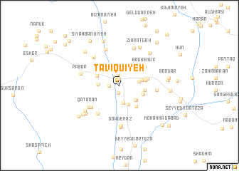
Ţāvīqu'īyeh (Kermān, Iran)Ţāvīqu'īyeh is a town in the Kermān region of Iran. An overview map of the region around Ţāvīqu'īyeh is displayed below.
regional and 3d topo map of Ţāvīqu'īyeh, Iran ::
Ţāvīqu'īyeh airports ::
The nearest airport is KER - Kerman, located 111.0 km north of Ţāvīqu'īyeh.
Nearby towns ::
Rūdbar (1.1km north) //
Gāzerū'īyeh (1.2km south) //
Bīdū'īyeh (1.4km west) //
Rūdbar (1.8km north) //
Şafā (2.7km south) //
Garīnow (2.8km east) //
Ebrāhīmābād (3.2km south) //
Dozdān (3.2km north east) //
Yakh Mūr (3.2km south east) //
Sarghashk (3.2km south east) //
Mūrūdū'īyeh (3.0km west) //
Kahnūj (3.2km east) //
Koshkū'īyeh (3.4km north west) //
Moḩammadābād (3.6km south east) //
Daghtak (3.6km east) //
Gerīnū (3.6km east) //
Solţānābād (4.0km south east) //
Nāşerābād (4.0km east) //
Bāgh-e Mūr (4.6km north east) //
Dāmaneh-ye Anjīr (5.3km south west) //
Langar (5.2km south west) //
Rubāra (5.2km east) //
Zamīnanjīr (5.6km north west) //
Qaţārān (5.5km south west) //
Golūnū'īyeh (5.9km north) //
Javārān (6.1km north) //
Gowd-e Raz (6.3km south) //
Rābor (5.6km west) //
Darvīn (6.5km south) //
[all distances 'as the bird flies' and approximate] 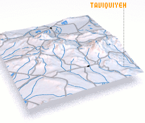 Places with similar names to Ţāvīqu'īyeh, Iran ::
Disclaimer :: Information on this page comes without warranty of any kind |
||
|
Where is Ţāvīqu'īyeh? Elevation and coordinates ::
Latitude (lat): 29°16'23"N Longitude (lon): 56°57'50"E
Elevation (approx.): 2178m (map arrows pan, magnifying glasses zoom) |
||
|
Visiting Ţāvīqu'īyeh? Hotel/Accommodation ::
Book a hotel in Ţāvīqu'īyeh Travel Guide ::
Buy a travel guide for Iran rental cars ::
car rental offers GPS waypoint ::
download a GPX waypoint (PoI) of Ţāvīqu'īyeh for your GPS receiver
|
||