|
search place name
|
||
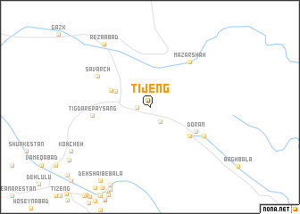
Tī Jeng (Kermān, Iran)Tī Jeng is a town in the Kermān region of Iran. An overview map of the region around Tī Jeng is displayed below.
regional and 3d topo map of Tī Jeng, Iran ::
Tī Jeng airports ::
The nearest airport is KER - Kerman, located 53.0 km south west of Tī Jeng.
Nearby towns ::
Jarīsqān (1.4km west) //
Deh Now-e Parvīz (2.1km south east) //
Hashtād Mīsh-e Haftomī (4.2km north west) //
Hashtād Mīsh-e Sovorch (4.2km north west) //
Sāgūrch-e Haftād Mīsh (4.6km north west) //
Dar Bīk (5.6km south east) //
Dorān (5.8km south east) //
Tīgdar-e Pāy Sang (6.3km west) //
Mazār Shāh (7.0km north east) //
Sāvarch (6.8km north west) //
Taqīābād (6.9km south east) //
Reẕāābād (9.3km north west) //
[all distances 'as the bird flies' and approximate] 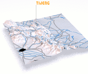 Places with similar names to Tī Jeng, Iran ::
Disclaimer :: Information on this page comes without warranty of any kind |
||
|
Where is Tī Jeng? Elevation and coordinates ::
Latitude (lat): 30°34'58"N Longitude (lon): 57°22'20"E
Elevation (approx.): 2183m (map arrows pan, magnifying glasses zoom) |
||
|
Visiting Tī Jeng? Hotel/Accommodation ::
Book a hotel in Tī Jeng Travel Guide ::
Buy a travel guide for Iran rental cars ::
car rental offers GPS waypoint ::
download a GPX waypoint (PoI) of Tī Jeng for your GPS receiver
|
||