|
search place name
|
||
Tol-e Bardangān (Fārs, Iran)Tol-e Bardangān is a town in the Fārs region of Iran. An overview map of the region around Tol-e Bardangān is displayed below.
regional and 3d topo map of Tol-e Bardangān, Iran ::

Tol-e Bardangān airports ::
The nearest airport is SYZ - Shiraz Shahid Dastghaib Intl, located 141.3 km south east of Tol-e Bardangān.
Other airports nearby include BUZ - Bushehr (148.2 km south), Nearby towns ::
Shūr Āb (0.9km south west) //
Gūsheh (1.7km north) //
Godār-e Nārenjūn (1.9km north east) //
Gardaneh-ye Tol-e Bardangān (1.9km north west) //
Cham-e Gaz (2.4km east) //
Mīāneh-ye Bardangān (2.4km east) //
Garmīsh (2.6km west) //
Kūh-e Nargesī (3.4km north) //
Narmūn (3.2km east) //
Shūrāb (3.8km south) //
Bātūn (3.9km north) //
Shūrāb-e Pā'īn (3.9km south) //
Shūrāb-e Bālā (4.0km south) //
Garmīū (3.9km west) //
Gaz Mīsh (4.1km west) //
Pīrdūn (5.3km north) //
Sākht-e Farhād (5.7km south west) //
Seyyed Laţīf (5.3km west) //
Gūr-e Espīd (6.4km south) //
Pīr Sorkh-e Bālā (5.8km south west) //
Pīr Shams (6.5km north) //
Gowd Espīd (6.7km south) //
Āb Morvārīd (6.7km south east) //
Tall Kohneh (6.9km north east) //
Nārenjān (6.8km north east) //
Delī Bīk (7.8km north) //
Pīr Sorkh-e Pāʼīn (7.1km south west) //
Tang-e Āyjūn (7.1km east) //
Cham Espīd (7.7km north west) //
[all distances 'as the bird flies' and approximate] 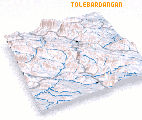 Places with similar names to Tol-e Bardangān, Iran :: Disclaimer :: Information on this page comes without warranty of any kind |
||
|
Where is Tol-e Bardangān? Elevation and coordinates ::
Latitude (lat): 30°12'20"N Longitude (lon): 51°20'33"E
Elevation (approx.): 824m (map arrows pan, magnifying glasses zoom) |
||
|
Visiting Tol-e Bardangān? Hotel/Accommodation ::
Book a hotel in Tol-e Bardangān Travel Guide ::
Buy a travel guide for Iran rental cars ::
car rental offers GPS waypoint ::
download a GPX waypoint (PoI) of Tol-e Bardangān for your GPS receiver
|
||