|
search place name
|
||
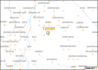
Tūnīān (Iran)Tūnīān is a town in Iran. An overview map of the region around Tūnīān is displayed below.
regional and 3d topo map of Tūnīān, Iran ::
Tūnīān airports ::
The nearest airport is RAS - Rasht, located 93.5 km north of Tūnīān.
Other airports nearby include RZR - Ramsar (108.8 km north east), THR - Teheran Mehrabad Intl (179.0 km south east), Nearby towns ::
Qal‘eh (1.5km west) //
Asbak (3.7km north) //
Qareh Davvalū (4.0km north) //
Qeshlāq Meydān (4.8km north west) //
Ḩeşār (4.8km north east) //
A‘lā'ī (4.8km south west) //
Kharzān (5.2km east) //
Qal‘eh Chāy (6.3km north west) //
Darvīsh Valī (6.3km north east) //
Mollā ‘Alī (6.3km north west) //
Ţarzān-e Soflá (6.2km west) //
Esmā‘īlābād (6.2km east) //
Gandāb-e Qeshlāq (7.6km north) //
Āstīn Darreh (7.1km south east) //
Esbavīn (8.0km south) //
Ḩeşār-e Valī (7.0km north east) //
Sūrī (8.2km south west) //
Qānshar Bolāgh (8.2km south east) //
Kūgīr-e ‘Olyā (8.7km north west) //
[all distances 'as the bird flies' and approximate] 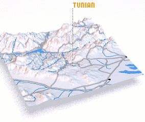 Places with similar names to Tūnīān, Iran ::
Disclaimer :: Information on this page comes without warranty of any kind |
||
|
Where is Tūnīān? Elevation and coordinates ::
Latitude (lat): 36°29'0"N Longitude (lon): 49°35'0"E
Elevation (approx.): 1303m (map arrows pan, magnifying glasses zoom) |
||
|
Visiting Tūnīān? Hotel/Accommodation ::
Book a hotel in Tūnīān Travel Guide ::
Buy a travel guide for Iran rental cars ::
car rental offers GPS waypoint ::
download a GPX waypoint (PoI) of Tūnīān for your GPS receiver
|
||