|
search place name
|
||
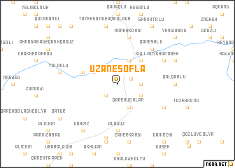
Ūzān-e Soflá (Ostān-e Āz̄arbāyjān-e Sharqī, Iran)Ūzān-e Soflá is a town in the Ostān-e Āz̄arbāyjān-e Sharqī region of Iran. An overview map of the region around Ūzān-e Soflá is displayed below.
regional and 3d topo map of Ūzān-e Soflá, Iran ::
Ūzān-e Soflá airports ::
The nearest airport is TBZ - Tabriz Intl, located 141.0 km north of Ūzān-e Soflá.
Other airports nearby include SDG - Sanandaj (186.9 km south), Nearby towns ::
Ūzān-e ‘Olyā (1.9km north east) //
‘Os̄mān Ūlan (2.4km south west) //
Tūpāghāj (3.0km east) //
Qareh Ūghlān (4.0km south) //
Ashīkhlū (4.0km north) //
Qīnarjeh (3.5km south east) //
Jabīklū (3.5km north west) //
Kūlī (4.7km north east) //
Malḩamlū (4.8km north west) //
Ālāgūz (7.4km south) //
Mameh Kandī (7.6km north) //
Qameshlū (7.1km north east) //
Leylakābād (7.0km south east) //
Gūy Kharābeh (7.0km north east) //
Şevarīn (8.7km south) //
Kahrīz (8.6km south west) //
[all distances 'as the bird flies' and approximate] 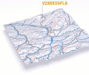 Places with similar names to Ūzān-e Soflá, Iran :: Disclaimer :: Information on this page comes without warranty of any kind |
||
|
Where is Ūzān-e Soflá? Elevation and coordinates ::
Latitude (lat): 36°54'0"N Longitude (lon): 46°37'0"E
Elevation (approx.): 1872m (map arrows pan, magnifying glasses zoom) |
||
|
Visiting Ūzān-e Soflá? Hotel/Accommodation ::
Book a hotel in Ūzān-e Soflá Travel Guide ::
Buy a travel guide for Iran rental cars ::
car rental offers GPS waypoint ::
download a GPX waypoint (PoI) of Ūzān-e Soflá for your GPS receiver
|
||