|
search place name
|
||
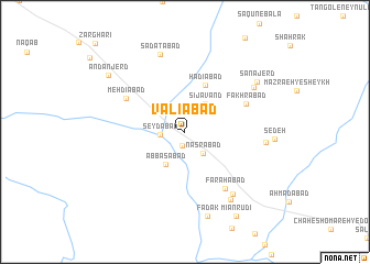
Valīābād (Khorāsān, Iran)Valīābād is a town in the Khorāsān region of Iran. An overview map of the region around Valīābād is displayed below.
regional and 3d topo map of Valīābād, Iran ::
Valīābād airports ::
The nearest airport is XBJ - Birjand, located 220.9 km south of Valīābād.
Nearby towns ::
Chamanābād (1.4km south) //
Şeydābād (2.1km west) //
Naşrābād (2.6km south east) //
Sījāvand (3.3km north east) //
‘Abbāsābād (3.7km south west) //
Hādīābād (5.0km north) //
Fakhrābād (5.8km north east) //
Mehdīābād (6.0km north west) //
Khalīlābād (6.7km south east) //
Faraḩābād (6.7km south east) //
Salmān (7.4km south east) //
Darvīshābād (6.8km east) //
S‘ādatābād (8.1km north) //
Ḩājjīābād (7.8km south east) //
Shīr Khān (7.3km north east) //
Fadak (8.8km south) //
Sanājerd (7.9km north east) //
Andanjerd (8.6km north west) //
Mīānrūdī (9.6km south east) //
[all distances 'as the bird flies' and approximate] 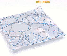 Places with similar names to Valīābād, Iran ::
// Velebit (BA)
// Velebit (BA)
// Valea Badii (RO)
// Valea Botei (RO)
// Valea Buţii (RO)
// Phulbāti (BD)
// Villa Betty (CO)
// Fal Abdou (NE)
// Fal Bada (NE)
// Falabut (SD)
Disclaimer :: Information on this page comes without warranty of any kind |
||
|
Where is Valīābād? Elevation and coordinates ::
Latitude (lat): 34°50'17"N Longitude (lon): 59°48'23"E
Elevation (approx.): 1036m (map arrows pan, magnifying glasses zoom) |
||
|
Visiting Valīābād? Hotel/Accommodation ::
Book a hotel in Valīābād Travel Guide ::
Buy a travel guide for Iran rental cars ::
car rental offers GPS waypoint ::
download a GPX waypoint (PoI) of Valīābād for your GPS receiver
|
||