|
search place name
|
||
Vaşat (Eşfahān, Iran)Vaşat is a town in the Eşfahān region of Iran. An overview map of the region around Vaşat is displayed below.
regional and 3d topo map of Vaşat, Iran ::
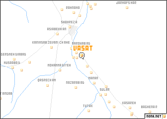
Nearby towns ::
Khosrowābād (1.4km west) //
Valandān (1.6km south east) //
Bābū Kān (2.1km north west) //
Roknābād (2.0km west) //
‘Amrowābād (2.5km north) //
Zīāratgāh (3.3km south east) //
Esfeh Sālār (3.4km north west) //
Moḩammadīyeh (5.1km south west) //
Mārān (5.6km south) //
Naz̧arābād (6.5km south) //
Chāh-e Karīm Sabzevārī (6.6km north west) //
Shahrezā (7.8km north) //
Qavvāmābād (7.5km south east) //
Āsīāb-e Khān (7.6km north west) //
Masīneh (8.7km south) //
Sūlār (9.0km south east) //
Qaşr-e Cham (9.0km south west) //
[all distances 'as the bird flies' and approximate]  Places with similar names to Vaşat, Iran ::
Disclaimer :: Information on this page comes without warranty of any kind |
||
|
Where is Vaşat? Elevation and coordinates ::
Latitude (lat): 31°56'43"N Longitude (lon): 51°53'14"E
Elevation (approx.): 1862m (map arrows pan, magnifying glasses zoom) |
||
|
Visiting Vaşat? Hotel/Accommodation ::
Book a hotel in Vaşat Travel Guide ::
Buy a travel guide for Iran rental cars ::
car rental offers GPS waypoint ::
download a GPX waypoint (PoI) of Vaşat for your GPS receiver
|
||