|
search place name
|
||
Vashīn Chāt (Sīstān va Balūchestān, Iran)Vashīn Chāt is a town in the Sīstān va Balūchestān region of Iran. An overview map of the region around Vashīn Chāt is displayed below.
regional and 3d topo map of Vashīn Chāt, Iran ::

Vashīn Chāt airports ::
The nearest airport is ZBR - Chah Bahar, located 77.4 km south west of Vashīn Chāt.
Other airports nearby include GWD - Gwadar (145.4 km south east), TRB - Turbo Turbat Intl (201.0 km east), Nearby towns ::
Machī Ḩasan (0.0km north) //
Gūrchārī (0.0km north) //
Vashīn Chat (0.7km north) //
Sonnī (0.8km north west) //
Mānderīyū (1.0km south east) //
Dansar (1.1km west) //
Ḩājjī Bāzār (1.5km south west) //
Band Gāh (1.7km east) //
Danī (2.5km south east) //
Talang (3.0km south east) //
Lālū Bāzār (3.0km south west) //
Tūkdan (3.1km north east) //
Shīr Moḩammad Bāzār (3.2km south) //
Dengarī (3.0km east) //
Dīrmān (3.5km south east) //
Būchchī (3.3km east) //
Shāhak Bāzār (3.6km south west) //
Dak (3.7km east) //
Mohīm Bāzār (4.2km north east) //
Dak (4.5km north west) //
Chorrak (4.9km south west) //
Kūtīrū (4.7km west) //
Jowrak (5.0km south west) //
Galūʼīsh (5.2km north east) //
Kachal (5.2km north east) //
Daddī (5.0km east) //
Bal (5.6km south) //
Nālvad (5.5km east) //
Dayermān (5.9km west) //
[all distances 'as the bird flies' and approximate] 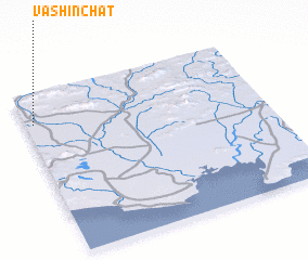 Places with similar names to Vashīn Chāt, Iran ::
// Vashīn Chat (IR)
Disclaimer :: Information on this page comes without warranty of any kind |
||
|
Where is Vashīn Chāt? Elevation and coordinates ::
Latitude (lat): 25°49'0"N Longitude (lon): 61°2'0"E
Elevation (approx.): 43m (map arrows pan, magnifying glasses zoom) |
||
|
Visiting Vashīn Chāt? Hotel/Accommodation ::
Book a hotel in Vashīn Chāt Travel Guide ::
Buy a travel guide for Iran rental cars ::
car rental offers GPS waypoint ::
download a GPX waypoint (PoI) of Vashīn Chāt for your GPS receiver
|
||