|
search place name
|
||
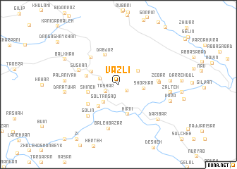
Vazlī (Ostān-e Kermānshāh, Iran)Vazlī is a town in the Ostān-e Kermānshāh region of Iran. An overview map of the region around Vazlī is displayed below.
regional and 3d topo map of Vazlī, Iran ::
Vazlī airports ::
The nearest airport is SDG - Sanandaj, located 71.9 km east of Vazlī.
Other airports nearby include KSH - Bakhtaran Shahid Ashrafi Esfahani (124.4 km south east), Nearby towns ::
Narvī (1.5km south east) //
Tashār (2.0km south west) //
Nowsūd (2.6km west) //
Solţān Sāq (3.4km south west) //
Nowdeshah (3.4km north east) //
Shorkān (3.3km east) //
Shū Shamshīr-e Bālā (4.0km north west) //
Sheykhān (4.3km south west) //
Ḩīrvī (4.8km south) //
Shīneh (4.1km west) //
Dabjūr (5.0km north) //
Shū Shamshīr-e Pā'īn (4.4km west) //
Khanānkar (5.0km south west) //
Ţawīlah (5.5km north west) //
Khānī Darreh (5.2km east) //
Zebār (5.2km east) //
Nesār (5.2km east) //
Ḩajīj-e Kūchek (5.3km east) //
Sūskān (5.6km north west) //
Golīn (6.3km south west) //
Baleh Bazār (7.1km south) //
Darreh Jaḩīj (6.7km east) //
Bīnarovah (6.7km east) //
Zalteh (6.8km east) //
Darī Bar (7.5km south east) //
Pālāniyah (6.9km west) //
Daratuwa (7.0km west) //
Varā (7.3km east) //
Balkhah (8.0km north west) //
[all distances 'as the bird flies' and approximate] 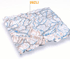 Places with similar names to Vazlī, Iran ::
Disclaimer :: Information on this page comes without warranty of any kind |
||
|
Where is Vazlī? Elevation and coordinates ::
Latitude (lat): 35°9'41"N Longitude (lon): 46°13'34"E
Elevation (approx.): 1567m (map arrows pan, magnifying glasses zoom) |
||
|
Visiting Vazlī? Hotel/Accommodation ::
Book a hotel in Vazlī Travel Guide ::
Buy a travel guide for Iran rental cars ::
car rental offers GPS waypoint ::
download a GPX waypoint (PoI) of Vazlī for your GPS receiver
|
||