|
search place name
|
||
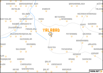
Yalābād (Iran)Yalābād is a town in Iran. An overview map of the region around Yalābād is displayed below.
regional and 3d topo map of Yalābād, Iran ::
Yalābād airports ::
The nearest airport is RAS - Rasht, located 110.1 km north of Yalābād.
Other airports nearby include RZR - Ramsar (118.3 km north east), THR - Teheran Mehrabad Intl (172.9 km south east), Nearby towns ::
Qeshlāq-e Marshūn (0.0km north) //
Asfastān (2.4km north west) //
Nīkūyeh (4.8km south) //
Chenārestān (4.8km west) //
Asadī (6.3km north west) //
Beyg Kandī (6.7km north) //
Fatanābād (6.0km east) //
Fashālanj (6.3km west) //
Ḩesāmābād (7.1km north east) //
Yazdeh Rūd (7.1km south east) //
Amīnābād (7.0km south west) //
[all distances 'as the bird flies' and approximate]  Places with similar names to Yalābād, Iran ::
// Yulbat (RU)
// Yellowbud (US)
// Yalibutu (CD)
// Yalābād (IR)
// Yāl Bād (IR)
// Yola Bodéoua (CM)
// Yola Bodéoua (CM)
Disclaimer :: Information on this page comes without warranty of any kind |
||
|
Where is Yalābād? Elevation and coordinates ::
Latitude (lat): 36°20'0"N Longitude (lon): 49°34'0"E
Elevation (approx.): 1451m (map arrows pan, magnifying glasses zoom) |
||
|
Visiting Yalābād? Hotel/Accommodation ::
Book a hotel in Yalābād Travel Guide ::
Buy a travel guide for Iran rental cars ::
car rental offers GPS waypoint ::
download a GPX waypoint (PoI) of Yalābād for your GPS receiver
|
||