|
search place name
|
||
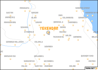
Yekeh Dar (Ostān-e Āz̄arbāyjān-e Gharbī, Iran)Yekeh Dar is a town in the Ostān-e Āz̄arbāyjān-e Gharbī region of Iran. An overview map of the region around Yekeh Dar is displayed below.
regional and 3d topo map of Yekeh Dar, Iran ::
Yekeh Dar airports ::
The nearest airport is TBZ - Tabriz Intl, located 139.5 km north east of Yekeh Dar.
Other airports nearby include VAN - Van (217.7 km north west), SDG - Sanandaj (269.6 km south east), Nearby towns ::
Chāpān (1.5km west) //
Bardeh Kesh (2.4km north east) //
Tāzeh Kand (3.5km south east) //
Eslāmlū (4.7km south west) //
Qameshlū (4.7km north east) //
Sīāvān (4.7km north west) //
Nāznāz (4.4km east) //
Tarseh Bolāgh (4.4km west) //
Dowrbeh (5.6km south) //
Nānās (4.8km north east) //
Qareh Dāgh (5.8km north east) //
‘Eyn or Rūm (5.9km west) //
Qūzūchī-ye Owlan (6.2km east) //
Gerdeh Gol (6.2km west) //
Dalow (6.2km east) //
Nārī (7.3km north east) //
‘Alīān (7.1km north west) //
Āqbolāgh Kānasbī (6.4km west) //
Gol Māvarān (7.0km north west) //
Sangar (8.5km north west) //
Eslāmābād (8.1km north east) //
[all distances 'as the bird flies' and approximate] 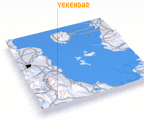 Places with similar names to Yekeh Dar, Iran ::
Disclaimer :: Information on this page comes without warranty of any kind |
||
|
Where is Yekeh Dar? Elevation and coordinates ::
Latitude (lat): 37°11'0"N Longitude (lon): 45°12'0"E
Elevation (approx.): 2266m (map arrows pan, magnifying glasses zoom) |
||
|
Visiting Yekeh Dar? Hotel/Accommodation ::
Book a hotel in Yekeh Dar Travel Guide ::
Buy a travel guide for Iran rental cars ::
car rental offers GPS waypoint ::
download a GPX waypoint (PoI) of Yekeh Dar for your GPS receiver
|
||