|
search place name
|
||
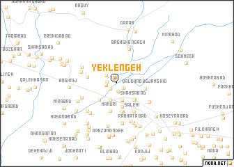
Yek Lengeh (Khorāsān, Iran)Yek Lengeh is a town in the Khorāsān region of Iran. An overview map of the region around Yek Lengeh is displayed below.
regional and 3d topo map of Yek Lengeh, Iran ::
Yek Lengeh airports ::
The nearest airport is ASB - Ashkhabad Ashgabat, located 194.9 km north of Yek Lengeh.
Nearby towns ::
Khorramak (1.1km south east) //
Ḩeşār Jūq (1.3km south) //
‘Eshqābād (1.1km south west) //
Ḩeşār-e Khūnī (1.2km south west) //
Pīr Komāj (1.3km west) //
‘Eshqābād (1.4km west) //
Farmak (1.4km west) //
Shādāb (1.9km north west) //
Seh Chūb (2.7km south) //
Zarandeh (2.7km south) //
Sangūnī (2.7km south) //
Neqāb (2.7km south) //
Dowlatābād (2.8km south) //
Seyfābād (2.8km south) //
Kalāghūn (3.4km south east) //
Shamsābād (3.4km south east) //
Deh-e Ḩallāj (3.4km south east) //
Yaḩyáābād (3.8km south) //
Ḩājjīān (3.4km south east) //
Moḩammadābād (3.5km south west) //
Manz̧ar (4.5km south) //
Ma‘mūrī (4.5km south) //
Feyẕābād (4.6km south) //
Feyẕābād (4.6km south) //
Dar Behesht (4.6km south) //
Qal‘eh Now-e Jamshīd (3.7km east) //
Sahlābād (4.0km west) //
Şāleḩī (5.0km south east) //
Shahrak (5.0km south east) //
[all distances 'as the bird flies' and approximate] 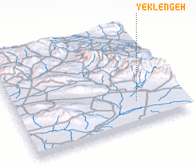 Places with similar names to Yek Lengeh, Iran ::
Disclaimer :: Information on this page comes without warranty of any kind |
||
|
Where is Yek Lengeh? Elevation and coordinates ::
Latitude (lat): 36°15'26"N Longitude (lon): 58°44'33"E
Elevation (approx.): 1205m (map arrows pan, magnifying glasses zoom) |
||
|
Visiting Yek Lengeh? Hotel/Accommodation ::
Book a hotel in Yek Lengeh Travel Guide ::
Buy a travel guide for Iran rental cars ::
car rental offers GPS waypoint ::
download a GPX waypoint (PoI) of Yek Lengeh for your GPS receiver
|
||