|
search place name
|
||
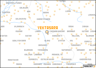
Yektā Sarā (Gīlān, Iran)Yektā Sarā is a town in the Gīlān region of Iran. An overview map of the region around Yektā Sarā is displayed below.
regional and 3d topo map of Yektā Sarā, Iran ::
Yektā Sarā airports ::
The nearest airport is RAS - Rasht, located 44.0 km north west of Yektā Sarā.
Other airports nearby include RZR - Ramsar (77.1 km east), THR - Teheran Mehrabad Intl (195.3 km south east), Nearby towns ::
Lasāneh (0.0km north) //
Javehrūd (2.4km south east) //
Cheshmeh Ḩeşār (3.0km east) //
Lābon (3.0km west) //
Ālāmū (3.7km south) //
Kelār Deh (3.0km west) //
Khaskhatī (3.5km south east) //
Sangeh Sar (3.5km south west) //
Khomeynī Sarā (5.0km north) //
Gandeh Sarā (4.8km north east) //
Band Sarī (5.8km south) //
Ākhūzī (4.8km south east) //
Ūyatem (5.8km south east) //
Lākārem (7.0km north) //
Halū Dasht (6.5km north west) //
Nānpa (7.3km north) //
Gand Lāvar (6.2km west) //
Sīstān (6.2km west) //
Tīnīshband (7.6km south) //
Sīgāsh (7.9km north) //
Lārkhānī (8.0km south) //
Mīāneh Sarā (8.6km south west) //
Pash-e Soflá (8.6km south east) //
Sīāmkhānī (8.6km south east) //
Mādar Sarā (9.0km north west) //
Shamīndīm (8.6km north west) //
Sūsarā (9.0km north west) //
Şūfīān Sar (9.5km south east) //
Bījārgāh (9.5km south west) //
[all distances 'as the bird flies' and approximate]  Places with similar names to Yektā Sarā, Iran :: Disclaimer :: Information on this page comes without warranty of any kind |
||
|
Where is Yektā Sarā? Elevation and coordinates ::
Latitude (lat): 36°58'0"N Longitude (lon): 49°49'0"E
Elevation (approx.): 595m (map arrows pan, magnifying glasses zoom) |
||
|
Visiting Yektā Sarā? Hotel/Accommodation ::
Book a hotel in Yektā Sarā Travel Guide ::
Buy a travel guide for Iran rental cars ::
car rental offers GPS waypoint ::
download a GPX waypoint (PoI) of Yektā Sarā for your GPS receiver
|
||