|
search place name
|
||
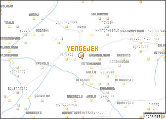
Yengejeh (Iran)Yengejeh is a town in Iran. An overview map of the region around Yengejeh is displayed below.
regional and 3d topo map of Yengejeh, Iran ::
Yengejeh airports ::
The nearest airport is RAS - Rasht, located 152.1 km south east of Yengejeh.
Nearby towns ::
Jegar Kandī (1.5km west) //
Khān Kandī (1.5km west) //
Sūlā (2.3km north) //
Pateh Khvor (2.4km south east) //
Ārpā Tappehsī (3.1km north east) //
Kenāzaq (2.9km west) //
Dāsh Bolāghī (2.9km east) //
Gollū (4.0km south) //
Ūlāghān (5.6km south) //
Khanaq Chāy (5.7km north) //
Dūdarān (5.7km north) //
Dovarjīn (5.7km south) //
Namīn (6.5km north) //
Nūjadeh (5.2km west) //
Solūţ (5.7km north west) //
Kelāsar (5.7km south east) //
Qarah Chanāq (6.3km south east) //
Khānqāh-e Bālā (7.1km north east) //
Karīm Kandī (7.1km south east) //
Qeshlāq Chāy (8.0km north) //
Dagermān Daraq (6.9km south east) //
Naneh Karān (6.6km east) //
Mīnābād (8.5km north east) //
Now Deh (8.6km north east) //
Sa‘īdābād (8.6km south east) //
[all distances 'as the bird flies' and approximate] 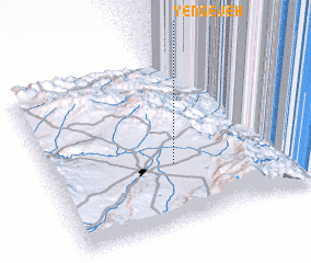 Places with similar names to Yengejeh, Iran ::
Disclaimer :: Information on this page comes without warranty of any kind |
||
|
Where is Yengejeh? Elevation and coordinates ::
Latitude (lat): 38°22'0"N Longitude (lon): 48°29'0"E
Elevation (approx.): 1325m (map arrows pan, magnifying glasses zoom) |
||
|
Visiting Yengejeh? Hotel/Accommodation ::
Book a hotel in Yengejeh Travel Guide ::
Buy a travel guide for Iran rental cars ::
car rental offers GPS waypoint ::
download a GPX waypoint (PoI) of Yengejeh for your GPS receiver
|
||