|
search place name
|
||
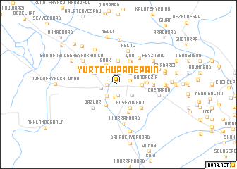
Yūrt Chūpān-e Pā'īn (Khorāsān, Iran)Yūrt Chūpān-e Pā'īn is a town in the Khorāsān region of Iran. An overview map of the region around Yūrt Chūpān-e Pā'īn is displayed below.
regional and 3d topo map of Yūrt Chūpān-e Pā'īn, Iran ::
Yūrt Chūpān-e Pā'īn airports ::
The nearest airport is ASB - Ashkhabad Ashgabat, located 159.3 km north west of Yūrt Chūpān-e Pā'īn.
Nearby towns ::
Ḩasanābād (1.7km south) //
Ḩasanābād-e īlkhānī (1.7km south) //
Deh Bāgh (1.8km north) //
Nūr od Dīn (1.5km west) //
Khavājeh Jarrāḩ (1.5km west) //
Gorū (1.6km east) //
Deh Bāgh (2.0km north) //
Kheyrābād (2.0km north) //
Akbarābād (2.1km south) //
Yūrt Chūpān-e Bālā (2.2km south) //
Khāmī (2.4km north east) //
Khāmī (2.4km north east) //
Ḩoseynābād-e Nīāzmandī (2.4km south west) //
Golshanābād (2.4km south east) //
Nūreddīn (2.3km west) //
Sārūjeh (2.9km north) //
Sark (3.4km north west) //
Samandar (2.9km east) //
Amīrābād (3.5km north west) //
Kombolān (3.0km east) //
Samandar (3.0km east) //
Mazang (3.7km north) //
Reẕāābād-e Sarhang (3.6km south west) //
Qom (4.0km north) //
Qom (4.0km north) //
Ḩoseynābād (3.5km north west) //
Tolkī (3.5km north west) //
Ḩoseynābād (4.0km south) //
Khūshāneh (4.0km north east) //
[all distances 'as the bird flies' and approximate] 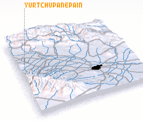 Places with similar names to Yūrt Chūpān-e Pā'īn, Iran :: Disclaimer :: Information on this page comes without warranty of any kind |
||
|
Where is Yūrt Chūpān-e Pā'īn? Elevation and coordinates ::
Latitude (lat): 36°40'1"N Longitude (lon): 59°4'0"E
Elevation (approx.): 1173m (map arrows pan, magnifying glasses zoom) |
||
|
Visiting Yūrt Chūpān-e Pā'īn? Hotel/Accommodation ::
Book a hotel in Yūrt Chūpān-e Pā'īn Travel Guide ::
Buy a travel guide for Iran rental cars ::
car rental offers GPS waypoint ::
download a GPX waypoint (PoI) of Yūrt Chūpān-e Pā'īn for your GPS receiver
|
||