|
search place name
|
||
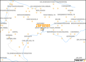
Za‘farān (Lorestān, Iran)Za‘farān is a town in the Lorestān region of Iran. An overview map of the region around Za‘farān is displayed below.
regional and 3d topo map of Za‘farān, Iran ::
Za‘farān airports ::
The nearest airport is KSH - Bakhtaran Shahid Ashrafi Esfahani, located 151.5 km north west of Za‘farān.
Other airports nearby include QMJ - Masjed Soleiman Shahid Asyaee (180.8 km south east), AWZ - Ahwaz (214.4 km south east), Nearby towns ::
Da‘vat Mālgah (1.0km north west) //
Seh Dārān-e Badarbek-e Soflá (1.6km south west) //
Seh Dārān-e Badarbek-e ‘Olyā (2.2km south west) //
Gūrī Sabz (2.5km north) //
Seyyed ‘Alī Panāh (3.8km east) //
Bon Karreh-ye Īmanqolī (4.0km east) //
Takhtāb-e Soflá (6.1km north) //
Kamcheh Kolā (5.8km north west) //
Bon Karreh-ye Kohzādvand (5.5km east) //
Takhtāb-e ‘Olyā (6.5km north) //
Balmīneh-ye Kelak Farāsh (5.7km west) //
Maham (5.9km north east) //
Garvazīr (6.4km south west) //
Dālāb (6.8km north east) //
Bonlasheh (8.0km north) //
Gorgalān (6.9km east) //
ChālKal-e ‘Olyā (7.5km south west) //
Safar Choqādī (7.6km south west) //
Gardangāh-e Shāh‘alī (8.3km north) //
Zīrtang-e Khowshāb (7.3km east) //
Choqāmīān-e Vālī (7.6km south east) //
Sheykh Morād (8.2km north west) //
Chūtāsh-e Yekshanbeh (8.8km south west) //
Chāl Kal-e Soflá (8.8km south west) //
Harshīr-e Īmānī (9.3km north west) //
Harshīr-e ‘Abbāsī (9.3km north west) //
Vāshīān-e Naşīr Tappeh (9.9km north west) //
Haft Cheshmeh (9.3km south west) //
Chāh Shīrīn-e Vāshīān (10.5km north west) //
[all distances 'as the bird flies' and approximate] 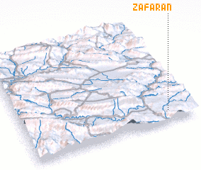 Places with similar names to Za‘farān, Iran ::
Disclaimer :: Information on this page comes without warranty of any kind |
||
|
Where is Za‘farān? Elevation and coordinates ::
Latitude (lat): 33°6'43"N Longitude (lon): 47°51'33"E
Elevation (approx.): 828m (map arrows pan, magnifying glasses zoom) |
||
|
Visiting Za‘farān? Hotel/Accommodation ::
Book a hotel in Za‘farān Travel Guide ::
Buy a travel guide for Iran rental cars ::
car rental offers GPS waypoint ::
download a GPX waypoint (PoI) of Za‘farān for your GPS receiver
|
||