|
search place name
|
||
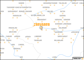
Zarū Sarā (Iran)Zarū Sarā is a town in Iran. An overview map of the region around Zarū Sarā is displayed below.
regional and 3d topo map of Zarū Sarā, Iran ::
Zarū Sarā airports ::
The nearest airport is RZR - Ramsar, located 23.6 km north east of Zarū Sarā.
Other airports nearby include RAS - Rasht (97.4 km north west), THR - Teheran Mehrabad Intl (143.3 km south east), Nearby towns ::
Bodāgh Sarā (0.0km north) //
Mehrān (1.5km east) //
Namak Darreh (1.9km north) //
Bāgh Dasht (3.7km north) //
Labā Sar (4.0km south) //
Māsarāsh (3.5km north west) //
Chortī (4.4km east) //
Jīr Rūd (4.8km south east) //
Şeyqal Maḩalleh (5.8km north) //
Takāmjān (5.8km south) //
Karīkesh (5.8km north east) //
Jīr Deh (6.4km south west) //
Chūtak (7.4km north) //
Sūrmeshk (6.2km east) //
Ekrā Sar (6.2km east) //
Tang Darreh (7.6km north) //
Javāher Deh (8.1km north) //
Kord Khīl (7.0km north east) //
Solmel (8.0km north) //
Palhamjān (8.1km south east) //
Ārmū (8.1km south east) //
Pā'īn Bāzū (8.6km north east) //
Asadollāh Khān (9.5km north west) //
[all distances 'as the bird flies' and approximate]  Places with similar names to Zarū Sarā, Iran ::
Disclaimer :: Information on this page comes without warranty of any kind |
||
|
Where is Zarū Sarā? Elevation and coordinates ::
Latitude (lat): 36°47'0"N Longitude (lon): 50°28'0"E
Elevation (approx.): 2113m (map arrows pan, magnifying glasses zoom) |
||
|
Visiting Zarū Sarā? Hotel/Accommodation ::
Book a hotel in Zarū Sarā Travel Guide ::
Buy a travel guide for Iran rental cars ::
car rental offers GPS waypoint ::
download a GPX waypoint (PoI) of Zarū Sarā for your GPS receiver
|
||