|
search place name
|
||
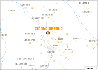
Ẕīā od Dīn-e Bālā (Khorāsān, Iran)Ẕīā od Dīn-e Bālā is a town in the Khorāsān region of Iran. An overview map of the region around Ẕīā od Dīn-e Bālā is displayed below.
regional and 3d topo map of Ẕīā od Dīn-e Bālā, Iran ::
Nearby towns ::
Ferezq (1.5km south east) //
Sar Kārīz (1.6km north east) //
Yaḩyáābād (2.1km south east) //
Dūgheshk (2.0km north east) //
Āghūyeh (2.4km south) //
Benhang (2.4km south east) //
Dīz Qand (3.0km south) //
Qandeshtan (3.0km south west) //
Nowbāhār (3.8km south) //
Kārīzak-e Khūjavī (3.3km east) //
Manz̧ar (3.6km south east) //
Şowma‘ah (3.9km south east) //
Deh Pā'īn (4.5km south west) //
Bahār Mashk (4.2km south west) //
Qāsemābād (5.0km south) //
Noqāb (4.7km south east) //
Maḩmūdābād (5.4km north) //
‘Oryān (5.5km south east) //
Torbat-e Ḩeydarīyeh (5.9km south) //
Bahārestān (6.2km north west) //
‘Abbāsābād (6.7km north) //
Şavah (5.8km south east) //
Asfīūkh (5.6km east) //
Ḩājjī Yār (6.5km south east) //
Fahandar (5.8km west) //
Mūreshk (7.7km south) //
Kūh-e Torbat (7.5km south) //
Dāshkhāneh (6.7km south west) //
Kūcheh-ye Moḩsenhā (7.0km south east) //
[all distances 'as the bird flies' and approximate] 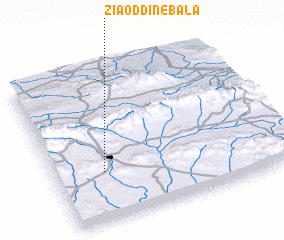 Places with similar names to Ẕīā od Dīn-e Bālā, Iran ::
// Steinabühl (DE)
// Steinbühl (DE)
// Steinbühl (DE)
// Steinbühl (DE)
// Steinbühl (DE)
// Steinbühl (DE)
// Steinbühl (DE)
// Steinbühl (DE)
// Zeytinbeli (TR)
// Şayyādān-e Bālā (IR)
Disclaimer :: Information on this page comes without warranty of any kind |
||
|
Where is Ẕīā od Dīn-e Bālā? Elevation and coordinates ::
Latitude (lat): 35°19'33"N Longitude (lon): 59°12'36"E
Elevation (approx.): 1440m (map arrows pan, magnifying glasses zoom) |
||
|
Visiting Ẕīā od Dīn-e Bālā? Hotel/Accommodation ::
Book a hotel in Ẕīā od Dīn-e Bālā Travel Guide ::
Buy a travel guide for Iran rental cars ::
car rental offers GPS waypoint ::
download a GPX waypoint (PoI) of Ẕīā od Dīn-e Bālā for your GPS receiver
|
||