|
search place name
|
||
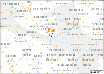
Ada (Punjab, Pakistan)Ada is a town in the Punjab region of Pakistan. An overview map of the region around Ada is displayed below.
regional and 3d topo map of Ada, Pakistan ::
Ada airports ::
The nearest airport is LYP - Faisalabad Intl, located 47.6 km north east of Ada.
Other airports nearby include MUX - Multan Intl (153.6 km south west), LHE - Lahore Allama Iqbal Intl (181.5 km east), Nearby towns ::
Kanna Kohta (1.6km east) //
Musalmāni (2.4km north west) //
Rurwāla (3.5km south) //
Balluāna (3.7km north) //
Umarpur (4.0km south west) //
Mānak Hirāj (4.0km north west) //
Montgomerywāla (3.7km north east) //
Karbala (3.6km east) //
Pīrewāla (4.6km west) //
Rāmpur (5.6km north) //
Muhammadpur (5.8km south) //
Kolu Devi (5.1km east) //
Aulia Sajjanpur (5.1km east) //
Dhaular (5.1km east) //
Thatta Namān (5.3km north west) //
Chak Four Hundred Twenty-eight (5.6km west) //
Bubak (6.0km south east) //
Dhepi Nāngal (6.0km south east) //
Bubak (6.4km south east) //
Jhok Sāhowāli (6.7km north) //
Ghanike Bangar (6.6km south west) //
Rām Krishan (7.1km north west) //
Jhok Sāhowāli (7.4km north) //
Dhiroke (7.4km south) //
Khalsābād (6.3km east) //
Patuāna (6.4km west) //
Phagwāra (6.6km south west) //
Fatehpur (7.6km south) //
Lef (7.6km north) //
[all distances 'as the bird flies' and approximate] 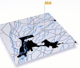 Places with similar names to Ada, Pakistan ::
Disclaimer :: Information on this page comes without warranty of any kind |
||
|
Where is Ada? Elevation and coordinates ::
Latitude (lat): 31°12'0"N Longitude (lon): 72°32'0"E
Elevation (approx.): 161m (map arrows pan, magnifying glasses zoom) |
||
|
Visiting Ada? Hotel/Accommodation ::
Book a hotel in Ada Travel Guide ::
Buy a travel guide for Pakistan rental cars ::
car rental offers GPS waypoint ::
download a GPX waypoint (PoI) of Ada for your GPS receiver
|
||