|
search place name
|
||
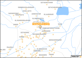
Ahmadābād (Sind, Pakistan)Ahmadābād is a town in the Sind region of Pakistan. An overview map of the region around Ahmadābād is displayed below.
regional and 3d topo map of Ahmadābād, Pakistan ::
Ahmadābād airports ::
The nearest airport is KHI - Karachi Jinnah Intl, located 56.9 km west of Ahmadābād.
Other airports nearby include BDN - Talhar (116.8 km east), WNS - Nawabshah (179.3 km north east), BHJ - Bhuj (257.2 km south east), Nearby towns ::
Nisār (1.6km east) //
Khāshkeli (1.9km south) //
Thahim (1.8km north west) //
Goth Murīd Memon (2.2km south east) //
Molvi Muhammad Arif (2.2km north west) //
Goth Sulaimān (2.4km north) //
Goth Sājan Memon (2.4km south east) //
Molvi Gul Muhammad (2.3km west) //
Jummu Same (2.8km south east) //
Goth Borio Jokhio (3.3km south) //
Goth Murīd (3.6km south west) //
Achār (3.7km south east) //
Bābra (4.1km south) //
Ali Ahmad Goth (4.2km north) //
Goth Ismāil (4.2km south) //
Goth Pinār (4.2km south west) //
Goth Jumman Faqīr (4.3km south) //
Goth Hāji Ejāz (5.0km south west) //
Goth Hāji Turābi (5.2km east) //
Nuro Jokhio (5.6km south west) //
Goth Hāji Chaglo Sālār (5.7km south east) //
Mīr Muhammad Saiyed (6.0km south west) //
Umar Katiār (6.3km north) //
Mīr Khān Chāndio (6.1km south west) //
Muhammad Arab Kātiar (6.5km south west) //
Alu Jamadār (6.6km north east) //
Hāji Sheru (6.6km south west) //
Goth Qāsim Khāshkheli (6.6km south west) //
Usmān Saiyed (7.0km south west) //
[all distances 'as the bird flies' and approximate] 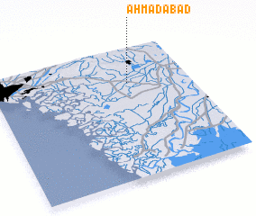 Places with similar names to Ahmadābād, Pakistan ::
Disclaimer :: Information on this page comes without warranty of any kind |
||
|
Where is Ahmadābād? Elevation and coordinates ::
Latitude (lat): 24°43'52"N Longitude (lon): 67°41'23"E
Elevation (approx.): 7m (map arrows pan, magnifying glasses zoom) |
||
|
Visiting Ahmadābād? Hotel/Accommodation ::
Book a hotel in Ahmadābād Travel Guide ::
Buy a travel guide for Pakistan rental cars ::
car rental offers GPS waypoint ::
download a GPX waypoint (PoI) of Ahmadābād for your GPS receiver
|
||