|
search place name
|
||
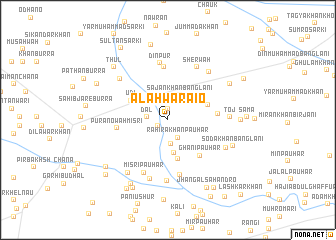
Alah Warāio (Sind, Pakistan)Alah Warāio is a town in the Sind region of Pakistan. An overview map of the region around Alah Warāio is displayed below.
regional and 3d topo map of Alah Warāio, Pakistan ::
Alah Warāio airports ::
The nearest airport is SKZ - Sukkur, located 50.9 km south of Alah Warāio.
Other airports nearby include SUL - Sui (62.2 km north east), MJD - Moenjodaro (115.1 km south west), RYK - Rahim Yar Khan Sheikh Zayed (144.9 km east), WNS - Nawabshah (221.5 km south), Nearby towns ::
Sāhibnu Drakhan (1.2km north) //
Chatha Dal (1.1km south west) //
Rahīra Khān Pauhar (2.2km south east) //
Dal (2.2km north west) //
Dal (2.1km west) //
Dhani Bakhsh Pauhar (2.6km south) //
Sājan Khān Banglāni (3.0km north east) //
Khairu Pauhar (3.7km south) //
Ghulām Qādir Jāfri (3.6km north east) //
Achar Pauhar (4.4km south) //
Udi (4.3km north west) //
Imām Bakhsh Jāfri (4.3km north east) //
Ghani Pauhar (5.1km south east) //
Arsala Khān Banglāni (4.9km east) //
Purāno Wāh Misri (5.1km west) //
Khosa (5.9km north) //
Jān Muhammad Khān Pauhar (6.3km south) //
Dīnpur (6.4km north) //
Misri Pauhar (6.3km south) //
Sher Wāh (6.5km north east) //
Murādpur (6.8km south) //
Sharbat Pauhar (6.9km south) //
Toj (6.1km east) //
Wārsadīn (6.6km north west) //
Ali Murād Khān Lashāri (6.8km north east) //
Gul Sher Pauhar (6.5km south east) //
Dari Khān Khosa (7.1km south west) //
Soda Khān Banglāni (7.0km south east) //
Muhammad Usmān Unāri (7.3km north east) //
[all distances 'as the bird flies' and approximate]  Places with similar names to Alah Warāio, Pakistan ::
// Alawuri (GH)
// Allāh Warāio (PK)
// Al Wahrah (OM)
// Al Warr (OM)
// Alawere (NG)
// Alawure (NG)
// Al ‘Uwayr (SY)
// Al Wa‘irah (SY)
// Al Wa‘rah (YE)
// Al Wa‘rah (YE)
Disclaimer :: Information on this page comes without warranty of any kind |
||
|
Where is Alah Warāio? Elevation and coordinates ::
Latitude (lat): 28°10'50"N Longitude (lon): 68°49'15"E
Elevation (approx.): 64m (map arrows pan, magnifying glasses zoom) |
||
|
Visiting Alah Warāio? Hotel/Accommodation ::
Book a hotel in Alah Warāio Travel Guide ::
Buy a travel guide for Pakistan rental cars ::
car rental offers GPS waypoint ::
download a GPX waypoint (PoI) of Alah Warāio for your GPS receiver
|
||