|
search place name
|
||
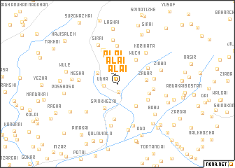
Alai (Balochistān, Pakistan)Alai is a town in the Balochistān region of Pakistan. An overview map of the region around Alai is displayed below.
regional and 3d topo map of Alai, Pakistan ::
Alai airports ::
The nearest airport is UET - Quetta, located 80.0 km south west of Alai.
Other airports nearby include KDH - Kandahar (154.5 km north west), Nearby towns ::
Alai (1.3km north) //
Kats (1.3km south) //
Udha (1.9km west) //
Alai (2.4km north) //
Ghunza (3.2km north west) //
Spīn Khezai (4.2km south west) //
Shahrgali (4.4km south east) //
Zadar (4.0km east) //
Wuch (4.6km north east) //
Gurk (4.6km east) //
Kwat (4.9km south east) //
Obo Saiyid (4.9km north east) //
Qamar (5.7km south) //
Rāgha (5.0km east) //
Barak (5.7km north) //
Urmazai (5.8km north) //
Ghez (5.1km east) //
Khāni (6.1km north) //
Mesha (5.4km west) //
Abu Chīna (6.1km south west) //
Kori Kata (6.3km north east) //
Urbasa (6.7km south) //
Sirai (6.7km north west) //
Shāhan (7.0km north) //
Salām Aghbargai (7.0km south) //
Ziāba (6.3km east) //
Shādīzai (6.3km west) //
Sra Khwa (7.4km south) //
Bābu (7.1km south east) //
[all distances 'as the bird flies' and approximate] 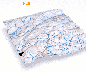 Places with similar names to Alai, Pakistan ::
Disclaimer :: Information on this page comes without warranty of any kind |
||
|
Where is Alai? Elevation and coordinates ::
Latitude (lat): 30°53'55"N Longitude (lon): 67°18'25"E
Elevation (approx.): 2175m (map arrows pan, magnifying glasses zoom) |
||
|
Visiting Alai? Hotel/Accommodation ::
Book a hotel in Alai Travel Guide ::
Buy a travel guide for Pakistan rental cars ::
car rental offers GPS waypoint ::
download a GPX waypoint (PoI) of Alai for your GPS receiver
|
||