|
search place name
|
||
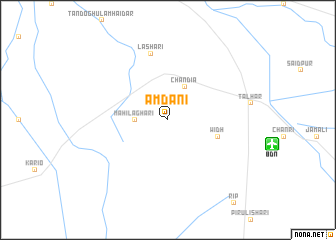
Amdāni (Sind, Pakistan)Amdāni is a town in the Sind region of Pakistan. An overview map of the region around Amdāni is displayed below.
regional and 3d topo map of Amdāni, Pakistan ::
Amdāni airports ::
The nearest airport is BDN - Talhar, located 11.0 km east of Amdāni.
Other airports nearby include WNS - Nawabshah (153.8 km north), KHI - Karachi Jinnah Intl (159.0 km west), BHJ - Bhuj (199.1 km south east), IXY - Kandla (238.9 km south east), Nearby towns ::
Jio (1.9km north) //
Māhi Laghāri (3.4km west) //
Chandia (4.1km north east) //
Widh (5.4km east) //
Lashāri (7.6km north) //
[all distances 'as the bird flies' and approximate]  Places with similar names to Amdāni, Pakistan ::
// Amden (CH)
// Amboatany (MG)
// Aymett Town (US)
// Ambi Danna (IN)
// Amutinu (GH)
// Amatán (MX)
// Amatán (MX)
// Amatán (MX)
// Ahmadān (PK)
// Ahmadāni (PK)
Disclaimer :: Information on this page comes without warranty of any kind |
||
|
Where is Amdāni? Elevation and coordinates ::
Latitude (lat): 24°52'0"N Longitude (lon): 68°44'0"E
Elevation (approx.): 14m (map arrows pan, magnifying glasses zoom) |
||
|
Visiting Amdāni? Hotel/Accommodation ::
Book a hotel in Amdāni Travel Guide ::
Buy a travel guide for Pakistan rental cars ::
car rental offers GPS waypoint ::
download a GPX waypoint (PoI) of Amdāni for your GPS receiver
|
||