|
search place name
|
||
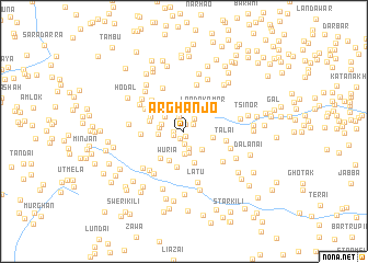
Arghanjo (North-West Frontier, Pakistan)Arghanjo is a town in the North-West Frontier region of Pakistan. An overview map of the region around Arghanjo is displayed below.
regional and 3d topo map of Arghanjo, Pakistan ::
Arghanjo airports ::
The nearest airport is JAA - Jalalabad, located 77.3 km north of Arghanjo.
Other airports nearby include PEW - Peshawar Intl (84.5 km east), KBL - Kabul Intl (163.7 km north west), SDT - Saidu Sharif (197.5 km north east), Nearby towns ::
Dre Sota (0.5km south) //
Pandher (0.8km north) //
Mopatai (0.8km south) //
Arye (0.8km west) //
Karīm Nmasai (1.1km north east) //
Krapai (1.0km south west) //
Cham Kani (1.3km south) //
Ashraf Nmasai (1.6km north) //
Allāhdad Nmasai (1.5km north east) //
Limāra Garhi (1.8km south) //
Khān Mīr Kili (2.2km south) //
Khānki Bāzār (2.3km south) //
Pakhar Nmasai (2.1km west) //
Ayār (2.2km north west) //
Babuzo Pakha (2.1km west) //
Ghaliban (2.4km south east) //
Pand Kule (2.2km west) //
Lando Kamar (2.8km north east) //
Star Kili (2.6km east) //
Tutānai (3.3km south) //
Wuria (3.3km south west) //
Khawano Kili (3.4km south west) //
Jabba (3.6km south) //
Mirzali Khel (3.1km west) //
Hissarak (3.3km north west) //
Spedār (3.4km north west) //
Wali Nmasai (3.9km north west) //
Adīre Nakka (3.7km west) //
Talai (3.7km east) //
[all distances 'as the bird flies' and approximate] 
Disclaimer :: Information on this page comes without warranty of any kind |
||
|
Where is Arghanjo? Elevation and coordinates ::
Latitude (lat): 33°43'0"N Longitude (lon): 70°39'49"E
Elevation (approx.): 1778m (map arrows pan, magnifying glasses zoom) |
||
|
Visiting Arghanjo? Hotel/Accommodation ::
Book a hotel in Arghanjo Travel Guide ::
Buy a travel guide for Pakistan rental cars ::
car rental offers GPS waypoint ::
download a GPX waypoint (PoI) of Arghanjo for your GPS receiver
|
||