|
search place name
|
||
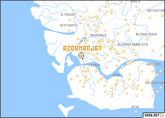
Āzo Amar Jat (Sind, Pakistan)Āzo Amar Jat is a town in the Sind region of Pakistan. An overview map of the region around Āzo Amar Jat is displayed below.
regional and 3d topo map of Āzo Amar Jat, Pakistan ::
Āzo Amar Jat airports ::
The nearest airport is KHI - Karachi Jinnah Intl, located 96.4 km north of Āzo Amar Jat.
Other airports nearby include BDN - Talhar (165.2 km north east), Nearby towns ::
Mobīn Jat (1.2km north) //
Gul Bijārāni (1.7km south) //
Ramun Badālo (1.9km north) //
Hāji Usmān Jat (1.9km north) //
Mahmūd Bijārāni (2.0km north east) //
Ramon Jat (2.2km north) //
Hāji Abdul Rahīm Jat (2.1km east) //
Hāshim Takro (2.5km south) //
Siddiq Muhammad Jat (2.4km north east) //
Somar Jat (2.5km north east) //
Bado Lāro (2.6km south) //
Beer Jat (2.6km north east) //
Hāji Karful (2.8km south) //
Miānji Ashraf (3.0km south) //
Sāleh Pukriyo (2.8km east) //
Hāji Gul Muhammad Jat (3.2km north) //
Ahmad Ali (3.2km east) //
Lado Gado (3.3km north east) //
Nāto (3.8km south) //
Lādo Mahāno (3.8km north) //
Āchār Jat (3.8km north) //
Ker Sar (3.6km south east) //
Hāji Abu Dablo (3.9km south) //
Hāji Māuruf Jat (3.7km north west) //
Hāji Muhammad Ali Lāra (4.0km south) //
Sheru Jat (3.9km south east) //
Hāji Chando Ronjo (4.1km north east) //
Karīno Baloch (4.3km north) //
Hāji Gado (4.4km north) //
[all distances 'as the bird flies' and approximate] 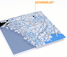 Places with similar names to Āzo Amar Jat, Pakistan :: Disclaimer :: Information on this page comes without warranty of any kind |
||
|
Where is Āzo Amar Jat? Elevation and coordinates ::
Latitude (lat): 24°4'30"N Longitude (lon): 67°26'25"E
Elevation (approx.): -32768m (map arrows pan, magnifying glasses zoom) |
||
|
Visiting Āzo Amar Jat? Hotel/Accommodation ::
Book a hotel in Āzo Amar Jat Travel Guide ::
Buy a travel guide for Pakistan rental cars ::
car rental offers GPS waypoint ::
download a GPX waypoint (PoI) of Āzo Amar Jat for your GPS receiver
|
||