|
search place name
|
||
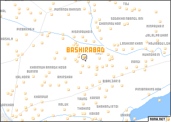
Bashīrābād (Sind, Pakistan)Bashīrābād is a town in the Sind region of Pakistan. An overview map of the region around Bashīrābād is displayed below.
regional and 3d topo map of Bashīrābād, Pakistan ::
Bashīrābād airports ::
The nearest airport is SKZ - Sukkur, located 39.8 km south of Bashīrābād.
Other airports nearby include SUL - Sui (72.5 km north east), MJD - Moenjodaro (105.1 km south west), RYK - Rahim Yar Khan Sheikh Zayed (148.8 km east), WNS - Nawabshah (210.2 km south), Nearby towns ::
Mulla Tāhir (1.2km south west) //
Behrām Pauhar (1.4km south east) //
Salār Khān Bhatti (1.6km north west) //
Rahīmābād (1.6km west) //
Ārija (1.9km west) //
Paniu Shur (2.1km north west) //
Nūr Muhammad Shujrah (2.6km north east) //
Sulaimān Sundri (2.6km south) //
Hāji Khān Bakhsh (2.5km south east) //
Got Mīr Muhammad (2.9km south east) //
Kāli (2.8km east) //
Gora Pauhar (3.6km south east) //
Sultān Shāh Niāz (3.5km east) //
Allāhda (3.9km north west) //
Nabi Bakhsh (4.1km north west) //
Sharbat Pauhar (4.5km north) //
Ghulām Muhammad Shūr (4.0km west) //
Wasand Kalhoro (4.4km north west) //
Murādpur (4.6km north) //
Ghāzi (4.2km east) //
Sulemān Pauhar (4.6km east) //
Gul Pauhar (4.6km east) //
Misri Pauhar (5.3km north) //
Ghulām Mustafa (5.2km south east) //
Tāhir Muhammad Khān (5.4km south) //
Pīr Bakhsh Pauhar (5.1km east) //
Dari Khān Khosa (5.7km north west) //
Fazal Muhammad Pauhar (5.9km south) //
Rahīm Bakhsh Sumra (5.2km east) //
[all distances 'as the bird flies' and approximate] 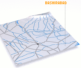 Places with similar names to Bashīrābād, Pakistan ::
// Bashīrābād (IR)
// Bashīrābād (IR)
// Bashīrābād (IR)
// Bashīrābād (IR)
// Boshrābād (IR)
// Boshrābād (IR)
// Bashīrābād (IN)
// Beshrabot (UZ)
// Bashīrābād (PK)
// Bashīrābād (PK)
Disclaimer :: Information on this page comes without warranty of any kind |
||
|
Where is Bashīrābād? Elevation and coordinates ::
Latitude (lat): 28°4'50"N Longitude (lon): 68°48'10"E
Elevation (approx.): 65m (map arrows pan, magnifying glasses zoom) |
||
|
Visiting Bashīrābād? Hotel/Accommodation ::
Book a hotel in Bashīrābād Travel Guide ::
Buy a travel guide for Pakistan rental cars ::
car rental offers GPS waypoint ::
download a GPX waypoint (PoI) of Bashīrābād for your GPS receiver
|
||