|
search place name
|
||
Chāh Hastāna (Punjab, Pakistan)Chāh Hastāna is a town in the Punjab region of Pakistan. An overview map of the region around Chāh Hastāna is displayed below.
regional and 3d topo map of Chāh Hastāna, Pakistan ::

Chāh Hastāna airports ::
The nearest airport is LYP - Faisalabad Intl, located 48.3 km south of Chāh Hastāna.
Other airports nearby include LHE - Lahore Allama Iqbal Intl (152.1 km east), ATQ - Amritsar (186.8 km east), ISB - Islamabad Chaklala (205.7 km north), MUX - Multan Intl (220.3 km south west), Nearby towns ::
Jabāna (0.8km north west) //
Tahliwāla Banjar (1.4km south west) //
Chāh Pipalwāla (1.4km north west) //
Dāwar (2.4km south east) //
Chāh Misrīwāla (2.3km north west) //
Chāh Kotwāla (2.2km east) //
Chak Bahādur (2.8km north) //
Chāh Kālūwāla (2.8km south) //
Gongapur (2.6km south east) //
Shāhbil Shāh ka Khu (2.7km south west) //
Chāh Rang Shāhwāla (2.7km south west) //
Pathānkot (3.3km south) //
Mughlānwāla (3.1km south west) //
Haweli Bāghu (3.1km north west) //
Chāh Miānwāla (3.6km south east) //
Kishanwāla Khu (4.0km north) //
Pīpalwāla Khu (4.1km south west) //
Chāh Jāniwāla (3.8km east) //
Kot Ismāīl (4.4km north east) //
Warotiwāla (4.1km south east) //
Chak Pilowāl Saiyidān (3.9km east) //
Khāna Deo (4.6km north) //
Madad Ali (4.2km south west) //
Chāh Muhammadwāla (4.4km south west) //
Nabu ka Thatta (4.9km south) //
Bahāuddīn (4.5km west) //
Chāh Samundarwāla (4.6km west) //
Kotlāla (5.2km south east) //
Chāh Ganjewāla (5.1km north west) //
[all distances 'as the bird flies' and approximate] 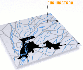 Places with similar names to Chāh Hastāna, Pakistan ::
// Chastain (US)
// Chestyne (UA)
// Chastnyy (RU)
// Chāh Sūdān (IR)
// Chase Eden (US)
// Cheston (US)
// Chestonia (US)
// Chasetown (US)
// Cheesetown (US)
// Ciastana (ID)
Disclaimer :: Information on this page comes without warranty of any kind |
||
|
Where is Chāh Hastāna? Elevation and coordinates ::
Latitude (lat): 31°46'35"N Longitude (lon): 72°49'40"E
Elevation (approx.): 176m (map arrows pan, magnifying glasses zoom) |
||
|
Visiting Chāh Hastāna? Hotel/Accommodation ::
Book a hotel in Chāh Hastāna Travel Guide ::
Buy a travel guide for Pakistan rental cars ::
car rental offers GPS waypoint ::
download a GPX waypoint (PoI) of Chāh Hastāna for your GPS receiver
|
||