|
search place name
|
||
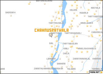
Chāh Nusratwāla (Punjab, Pakistan)Chāh Nusratwāla is a town in the Punjab region of Pakistan. An overview map of the region around Chāh Nusratwāla is displayed below.
regional and 3d topo map of Chāh Nusratwāla, Pakistan ::
Chāh Nusratwāla airports ::
The nearest airport is LYP - Faisalabad Intl, located 87.2 km east of Chāh Nusratwāla.
Other airports nearby include MUX - Multan Intl (151.9 km south west), Nearby towns ::
Thatti Saiyidan (1.1km east) //
Aliāna (1.6km east) //
Thatti Ali (1.6km east) //
Sāhjhar (2.2km south east) //
Sahjhar (2.2km south east) //
Haweli Hāji Mahmūd (2.7km north east) //
Guniāna (2.7km north east) //
Naya Thatta (3.1km south) //
Siāl (3.4km south) //
Khānpur (3.5km north) //
Sangra (4.0km north) //
Kot Shākir (4.0km north) //
Māchhiāna (4.3km south) //
Joya (4.3km north) //
Thatti Musalli (4.3km north) //
Ahmadābād (4.3km north) //
Thatti Ahmad (4.5km north east) //
Māchhiāna (5.5km south) //
Chak Aliāna (5.2km north east) //
Fateh Shāhwāla (6.0km north) //
Ahmadpur (6.2km south) //
Umrāna (6.2km south) //
Kaharwāla (6.3km north) //
Thatta Kanhaiya Lāl (6.8km south) //
Khokhar (6.7km north east) //
Kot Langar (7.1km south) //
Māchhīwāl (7.1km south) //
Chāndno (7.3km north) //
Retwāla (7.2km north) //
[all distances 'as the bird flies' and approximate]  Places with similar names to Chāh Nusratwāla, Pakistan ::
// Chāh Nusratwāla (PK)
Disclaimer :: Information on this page comes without warranty of any kind |
||
|
Where is Chāh Nusratwāla? Elevation and coordinates ::
Latitude (lat): 31°26'50"N Longitude (lon): 72°5'0"E
Elevation (approx.): 160m (map arrows pan, magnifying glasses zoom) |
||
|
Visiting Chāh Nusratwāla? Hotel/Accommodation ::
Book a hotel in Chāh Nusratwāla Travel Guide ::
Buy a travel guide for Pakistan rental cars ::
car rental offers GPS waypoint ::
download a GPX waypoint (PoI) of Chāh Nusratwāla for your GPS receiver
|
||