|
search place name
|
||
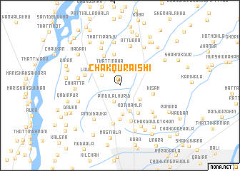
Chak Quraishi (Punjab, Pakistan)Chak Quraishi is a town in the Punjab region of Pakistan. An overview map of the region around Chak Quraishi is displayed below.
regional and 3d topo map of Chak Quraishi, Pakistan ::
Chak Quraishi airports ::
The nearest airport is LYP - Faisalabad Intl, located 76.3 km east of Chak Quraishi.
Other airports nearby include MUX - Multan Intl (174.3 km south west), Nearby towns ::
Pindi Lāl Murid (2.6km south) //
Sabhāga (2.9km north west) //
Thatti Nawa (3.2km north west) //
Khāl Gādhi (3.4km south east) //
Kot Imāmla (4.2km south) //
Munda (4.6km south) //
Ghaunspur (5.0km north) //
Thatta Kamīra (5.0km north) //
Bhasin (4.9km south east) //
Muhammad Kot (5.1km north west) //
Lāl Dātri (5.3km south) //
Hisām (4.6km east) //
Shāhrīn (5.7km south) //
Lau (5.0km west) //
Bhamb (6.1km south) //
Attuana (6.3km north) //
Shāh Jindan (6.4km north west) //
Kot Ali Yār (6.0km south east) //
Wīnpāi (5.7km west) //
Pindi Dauka (6.4km south west) //
Kot Khushhāl (6.8km north) //
Bakhsha (6.1km south west) //
Kherewāla (6.8km north east) //
Chhatta (6.1km west) //
Chak Vīrwāli (7.0km south east) //
Muhārwāli (6.7km south east) //
Thatti Panju (7.2km north) //
Chak Kālra (7.4km south) //
Berwāli (7.7km south east) //
[all distances 'as the bird flies' and approximate] 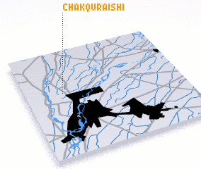 Places with similar names to Chak Quraishi, Pakistan ::
// Chak Quraishi (PK)
// Chak Quraishi (PK)
Disclaimer :: Information on this page comes without warranty of any kind |
||
|
Where is Chak Quraishi? Elevation and coordinates ::
Latitude (lat): 31°36'21"N Longitude (lon): 72°14'32"E
Elevation (approx.): 162m (map arrows pan, magnifying glasses zoom) |
||
|
Visiting Chak Quraishi? Hotel/Accommodation ::
Book a hotel in Chak Quraishi Travel Guide ::
Buy a travel guide for Pakistan rental cars ::
car rental offers GPS waypoint ::
download a GPX waypoint (PoI) of Chak Quraishi for your GPS receiver
|
||