|
search place name
|
||
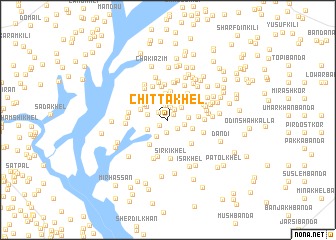
Chitta Khel (North-West Frontier, Pakistan)Chitta Khel is a town in the North-West Frontier region of Pakistan. An overview map of the region around Chitta Khel is displayed below.
regional and 3d topo map of Chitta Khel, Pakistan ::
Chitta Khel airports ::
The nearest airport is PEW - Peshawar Intl, located 131.4 km north east of Chitta Khel.
Other airports nearby include JAA - Jalalabad (167.3 km north), PZH - Zhob (220.4 km south west), KBL - Kabul Intl (239.4 km north west), SDT - Saidu Sharif (248.7 km north east), Nearby towns ::
Meuzi (0.8km north east) //
Budīn Khel (1.0km south west) //
Muhammad Khān Kalla (1.2km north west) //
Topan Kalla (1.4km south) //
Sirki Khel (1.3km south east) //
Ayūb Khān Kalla (1.4km north) //
Wazīr Kala (1.4km north east) //
Kotka Ainullah Khān (1.6km north) //
Derre Piāri Kalla (1.6km east) //
Hakīm Khān Kalla (1.9km north east) //
Wodīn Kalla (1.9km east) //
Jalandar Shāh (2.2km south west) //
Kotka Hāji Zar Khān Kalla (2.3km north west) //
Mīr Alī Kalla (2.0km west) //
Sanda Kalla (2.4km north) //
Gadi Tap (2.2km south west) //
Karab Kalla (2.7km north) //
Kotka Sāhib Dīn (2.7km north) //
Māle Khān Kalla (2.4km north west) //
Khalagdād Kalla (2.8km north) //
Azīm Kalla Jadīd (2.5km east) //
Geni (3.0km north) //
Kati Khel (3.0km north) //
Shamir Khel (2.8km north west) //
Kotka Muhabbat Khān (3.2km north) //
Kotka Muhāammad Ayaz Khān (2.8km north west) //
Mīr Akbar Kalla (3.2km south west) //
Kotka Saifullah Khān (2.9km east) //
Agri Kalla (3.5km north east) //
[all distances 'as the bird flies' and approximate]  Places with similar names to Chitta Khel, Pakistan ::
// Shād Khāl (IR)
// Chewdai Khullah (PK)
// Shādi Khel (PK)
// Shādi Khel (PK)
// Shādi Khel (PK)
// Shādu Khel (PK)
// Shāti Khel (PK)
// Shātu Khel (PK)
// Shādi Khel (PK)
// Shitkhala (RU)
Disclaimer :: Information on this page comes without warranty of any kind |
||
|
Where is Chitta Khel? Elevation and coordinates ::
Latitude (lat): 32°55'44"N Longitude (lon): 70°53'46"E
Elevation (approx.): 372m (map arrows pan, magnifying glasses zoom) |
||
|
Visiting Chitta Khel? Hotel/Accommodation ::
Book a hotel in Chitta Khel Travel Guide ::
Buy a travel guide for Pakistan rental cars ::
car rental offers GPS waypoint ::
download a GPX waypoint (PoI) of Chitta Khel for your GPS receiver
|
||