|
search place name
|
||
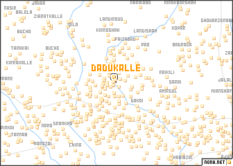
Dādu Kalle (North-West Frontier, Pakistan)Dādu Kalle is a town in the North-West Frontier region of Pakistan. An overview map of the region around Dādu Kalle is displayed below.
regional and 3d topo map of Dādu Kalle, Pakistan ::
Dādu Kalle airports ::
The nearest airport is PEW - Peshawar Intl, located 43.6 km south west of Dādu Kalle.
Other airports nearby include SDT - Saidu Sharif (76.9 km north east), JAA - Jalalabad (114.6 km west), ISB - Islamabad Chaklala (148.7 km south east), MFG - Muzaffarabad (162.5 km east), Nearby towns ::
Wazīr Kaka Kalle (0.4km north) //
Dheri Kalle (0.4km west) //
Darub Nāe Kalle (0.5km south west) //
Yār Khān Korūna (0.8km north east) //
Ajārā Kalle (0.8km south east) //
Akbar Khān Kalle (0.9km north) //
Hindu Kalle (1.0km south west) //
Mughal Khān (1.2km west) //
Muhammadji Korūna (1.2km east) //
Rāgh (1.3km west) //
Ahsām Korūna (1.4km north west) //
Bājāwara Kalle (1.6km north) //
Mīr Ālam Kalle (1.7km south) //
Ajūn Kalle (1.6km north west) //
Pīrān Kalle (1.7km west) //
Ghazan Kalle (1.7km north west) //
Muzaffar Khān Kalle (1.8km south west) //
Kudai (2.0km north west) //
Ammer Khān Kalle (2.1km north) //
Muzaffar Khān (1.7km west) //
Jānān Korūna (2.1km north east) //
Shāh Ālam Korūna (1.9km north east) //
Daulat Khān Kili (2.2km south) //
Miān Ismatullāh Kalle (2.3km south) //
Sāz Gul (2.0km west) //
Sardār Korūna (2.3km south east) //
Māma Je Kalle (2.1km south west) //
Qadim Kalle (2.4km south west) //
Sehri (2.5km north) //
[all distances 'as the bird flies' and approximate]  Places with similar names to Dādu Kalle, Pakistan ::
// Tata-Gol (RU)
// Dadağlı (TR)
// Dadağlı (TR)
// Dedegül (TR)
// Dedeoğlu (TR)
// Dudaklı (TR)
// Dodo-Gol (RU)
// Kāl-e Dadeh (IR)
// Tatakouélé (BF)
// Tatoukila (CG)
Disclaimer :: Information on this page comes without warranty of any kind |
||
|
Where is Dādu Kalle? Elevation and coordinates ::
Latitude (lat): 34°20'19"N Longitude (lon): 71°44'34"E
Elevation (approx.): 396m (map arrows pan, magnifying glasses zoom) |
||
|
Visiting Dādu Kalle? Hotel/Accommodation ::
Book a hotel in Dādu Kalle Travel Guide ::
Buy a travel guide for Pakistan rental cars ::
car rental offers GPS waypoint ::
download a GPX waypoint (PoI) of Dādu Kalle for your GPS receiver
|
||