|
search place name
|
||
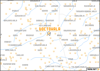
Doctowāla (Punjab, Pakistan)Doctowāla is a town in the Punjab region of Pakistan. An overview map of the region around Doctowāla is displayed below.
regional and 3d topo map of Doctowāla, Pakistan ::
Doctowāla airports ::
The nearest airport is MUX - Multan Intl, located 93.0 km west of Doctowāla.
Other airports nearby include LYP - Faisalabad Intl (134.2 km north east), Nearby towns ::
Hayātpur (0.9km south) //
Chak Fifty-one-Fifteen L (0.9km west) //
Rāikot (1.9km north east) //
Bhainj Khichchiān (2.2km south) //
Khichchiānwāla (2.9km south) //
Kotla Budhu (3.0km north west) //
Gulshan (3.2km west) //
Bādli (3.5km east) //
Khānsar (4.5km north) //
Jandiāli (4.2km south west) //
Ānandsar (4.7km north) //
Muttānwāla (4.6km north east) //
Bhattiānwāla (5.0km south) //
Balochānwāla (5.1km south) //
Dabhūli (5.4km north west) //
Chak Ninety-six (5.3km north west) //
Chaurānwāla (5.7km south west) //
Ārjangarh (5.4km north west) //
Hotwāla (5.5km south west) //
Basti Mohānphala (6.1km south) //
Madina (5.7km south east) //
Raīspur (6.4km west) //
Durk (7.3km south west) //
Old Chak Thirty-seven-Two Hundred Eight (7.6km south) //
Naurangpur (6.6km east) //
Sītāpur (6.8km north west) //
Khangrānwāla (7.2km south west) //
Kot Wijjhi (6.9km south west) //
Bhaini Beleywāli (7.2km north west) //
[all distances 'as the bird flies' and approximate]  Places with similar names to Doctowāla, Pakistan ::
// Takhtuwāla (PK)
Disclaimer :: Information on this page comes without warranty of any kind |
||
|
Where is Doctowāla? Elevation and coordinates ::
Latitude (lat): 30°16'35"N Longitude (lon): 72°22'55"E
Elevation (approx.): 144m (map arrows pan, magnifying glasses zoom) |
||
|
Visiting Doctowāla? Hotel/Accommodation ::
Book a hotel in Doctowāla Travel Guide ::
Buy a travel guide for Pakistan rental cars ::
car rental offers GPS waypoint ::
download a GPX waypoint (PoI) of Doctowāla for your GPS receiver
|
||