|
search place name
|
||
Dullewāla (Punjab, Pakistan)Dullewāla is a town in the Punjab region of Pakistan. An overview map of the region around Dullewāla is displayed below.
regional and 3d topo map of Dullewāla, Pakistan ::

Dullewāla airports ::
The nearest airport is LYP - Faisalabad Intl, located 157.0 km east of Dullewāla.
Other airports nearby include MUX - Multan Intl (180.7 km south), PZH - Zhob (194.2 km west), ISB - Islamabad Chaklala (252.0 km north east), Nearby towns ::
Masjidwāla (0.9km north) //
Bohrānwāla (1.0km south east) //
Chāh Nusratwāla (1.1km north west) //
Latīf Janju (1.0km east) //
Hastīwāla (1.7km north) //
Chāh Sālārwāla (2.3km north) //
Miānwāla (2.4km north) //
Hājī Hākimwāla (2.6km north east) //
Gharoka (2.7km west) //
Hendanwāla (2.7km east) //
Muhammad Khānwāla (2.9km north east) //
Nibhuwāla (3.2km east) //
Manīwāla (3.3km east) //
Powāliānwāla (4.5km north west) //
Mochīwāla (4.7km north east) //
Hājīwāla (5.3km north east) //
Khu Allāh Ditta Jhamat (7.7km east) //
Jhamat (8.6km south east) //
Gādai (8.5km north west) //
[all distances 'as the bird flies' and approximate] 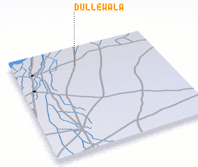 Places with similar names to Dullewāla, Pakistan ::
Disclaimer :: Information on this page comes without warranty of any kind |
||
|
Where is Dullewāla? Elevation and coordinates ::
Latitude (lat): 31°50'0"N Longitude (lon): 71°26'0"E
Elevation (approx.): 181m (map arrows pan, magnifying glasses zoom) |
||
|
Visiting Dullewāla? Hotel/Accommodation ::
Book a hotel in Dullewāla Travel Guide ::
Buy a travel guide for Pakistan rental cars ::
car rental offers GPS waypoint ::
download a GPX waypoint (PoI) of Dullewāla for your GPS receiver
|
||