|
search place name
|
||
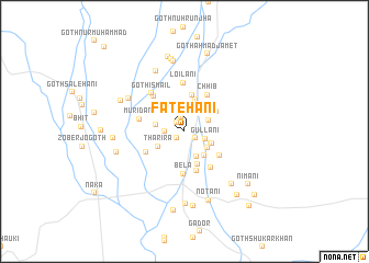
Fatehāni (Balochistān, Pakistan)Fatehāni is a town in the Balochistān region of Pakistan. An overview map of the region around Fatehāni is displayed below.
regional and 3d topo map of Fatehāni, Pakistan ::
Fatehāni airports ::
The nearest airport is KHI - Karachi Jinnah Intl, located 173.4 km south east of Fatehāni.
Other airports nearby include MJD - Moenjodaro (216.3 km north east), Nearby towns ::
Sānjāri (0.9km south west) //
GothHāji Allu (1.2km north west) //
Mūsāni (1.1km south east) //
Kechan (1.5km north) //
Sūmrāni (1.8km west) //
Ghari (2.1km north) //
Gullāni (2.1km east) //
Mubārakāni (2.4km north east) //
Machuwāra Goth (2.5km north east) //
Goth Mundra (2.8km south east) //
Rāwāri (2.7km south east) //
Mullaka (2.7km south east) //
Goth Saiyid Bahrām Shāh (2.9km north) //
Goth Shaikh Māngīa (2.9km north west) //
Goth Hāji Hārūn (2.7km west) //
Rabbuwāni (2.8km south east) //
Tharira (2.8km south west) //
Motiāni (3.1km south east) //
Bāgh Sanjāri (3.2km north west) //
Chārkhewāra Goth (3.4km north) //
Sadrāni (3.6km south) //
Aqūbāni (3.8km north) //
Chhib (3.5km north east) //
Karia Pīr (4.2km south) //
Hussenāni (4.0km south east) //
Bela (4.3km south) //
Chhib (4.2km north east) //
Hālad (4.1km south west) //
Gozāni (4.4km south east) //
[all distances 'as the bird flies' and approximate] 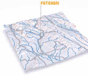 Places with similar names to Fatehāni, Pakistan ::
Disclaimer :: Information on this page comes without warranty of any kind |
||
|
Where is Fatehāni? Elevation and coordinates ::
Latitude (lat): 26°16'20"N Longitude (lon): 66°19'5"E
Elevation (approx.): 105m (map arrows pan, magnifying glasses zoom) |
||
|
Visiting Fatehāni? Hotel/Accommodation ::
Book a hotel in Fatehāni Travel Guide ::
Buy a travel guide for Pakistan rental cars ::
car rental offers GPS waypoint ::
download a GPX waypoint (PoI) of Fatehāni for your GPS receiver
|
||