|
search place name
|
||
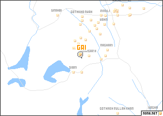
Gai (Balochistān, Pakistan)Gai is a town in the Balochistān region of Pakistan. An overview map of the region around Gai is displayed below.
regional and 3d topo map of Gai, Pakistan ::
Gai airports ::
The nearest airport is UET - Quetta, located 113.5 km north west of Gai.
Other airports nearby include SUL - Sui (176.1 km south east), SKZ - Sukkur (220.0 km south east), PZH - Zhob (282.8 km north east), Nearby towns ::
Mehrgarh (1.6km east) //
Kot Raīsāni (2.6km north) //
Kot Mengal (2.7km north west) //
Kot (2.8km north west) //
Naushahra (3.2km south) //
Zorgarh (3.3km north) //
Sibri (3.6km south west) //
Kot Kāhi (4.2km north) //
Pīr Shāh Bandul (4.2km north) //
Khāngarh (3.9km east) //
Kot Faiz Bakhsh (4.6km north) //
Goth Naghāri (4.9km east) //
Naghāri (5.6km east) //
Mīr Bāgh (6.4km north) //
Charkhi (6.7km north east) //
Soni Jalambāni (7.5km north east) //
Goth Ghāngu (7.7km north) //
Goth Chotāi (8.0km north) //
Pīr Dooāsi (8.6km north) //
Goth Ghulām Bulak (8.8km north) //
Goth Kurd (9.0km north) //
Wāhn (9.0km north east) //
Dādhar (10.2km north east) //
[all distances 'as the bird flies' and approximate]  Places with similar names to Gai, Pakistan ::
Disclaimer :: Information on this page comes without warranty of any kind |
||
|
Where is Gai? Elevation and coordinates ::
Latitude (lat): 29°23'45"N Longitude (lon): 67°35'0"E
Elevation (approx.): 152m (map arrows pan, magnifying glasses zoom) |
||
|
Visiting Gai? Hotel/Accommodation ::
Book a hotel in Gai Travel Guide ::
Buy a travel guide for Pakistan rental cars ::
car rental offers GPS waypoint ::
download a GPX waypoint (PoI) of Gai for your GPS receiver
|
||