|
search place name
|
||
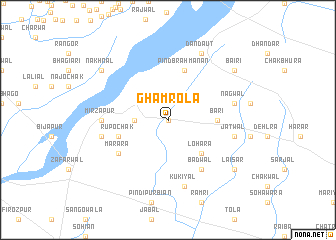
Ghamrola (Punjab, Pakistan)Ghamrola is a town in the Punjab region of Pakistan. An overview map of the region around Ghamrola is displayed below.
regional and 3d topo map of Ghamrola, Pakistan ::
Ghamrola airports ::
The nearest airport is IXJ - Jammu, located 35.5 km north west of Ghamrola.
Other airports nearby include IXP - Pathankot (62.5 km east), ATQ - Amritsar (78.9 km south), LHE - Lahore Allama Iqbal Intl (112.5 km south west), SXR - Srinagar (177.3 km north), Nearby towns ::
Darmān (0.0km north) //
Kot Naju (3.1km west) //
Lohāra (4.9km south east) //
Bari (4.7km east) //
Rupo Chak (5.0km west) //
Pind Brahmanān (5.8km north) //
Badwāl (6.4km south east) //
Marāra (6.0km south west) //
Mirzāpur (6.3km west) //
Kukiyāl (7.6km south) //
Jatwāl (6.5km east) //
Amrāl (6.5km west) //
Nagwāl (6.5km east) //
Dandaut (8.0km north east) //
Laisar (8.4km south east) //
Bairi (8.4km north east) //
Nakhnal (8.4km north west) //
[all distances 'as the bird flies' and approximate] 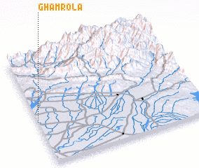 Places with similar names to Ghamrola, Pakistan ::
// Phumĭ Aôral (KH)
// Phumĭ Reul (KH)
// Phumĭ Reul (KH)
// Phumĭ Reul (KH)
// Phumĭ Riĕl (KH)
// Famberla (BF)
// Famorola (ML)
Disclaimer :: Information on this page comes without warranty of any kind |
||
|
Where is Ghamrola? Elevation and coordinates ::
Latitude (lat): 32°24'0"N Longitude (lon): 75°0'0"E
Elevation (approx.): 282m (map arrows pan, magnifying glasses zoom) |
||
|
Visiting Ghamrola? Hotel/Accommodation ::
Book a hotel in Ghamrola Travel Guide ::
Buy a travel guide for Pakistan rental cars ::
car rental offers GPS waypoint ::
download a GPX waypoint (PoI) of Ghamrola for your GPS receiver
|
||